kids encyclopedia robot

Districts of Sri Lanka facts for kids

Kids Encyclopedia Facts

In Sri Lanka, districts (Sinhala: දිස්ත්‍රි‌ක්‌ක, Tamil: மாவட்டம்) are the second-level administrative divisions. The first level are the provinces. Each province contains a number of districts. There are 25 districts in the country. They are organized into 9 provinces. Each district is administered under a District Secretary. Secretaries are appointed by the central government.

Districts

Sri Lanka Districts
Map of Sri Lanka showing districts.

All population numbers are from the most recent census of Sri Lanka, in 2012. Population density has been calculated using the land area rather than the total area (total area would have included the area of rivers and lakes).

District Area map Province District
capital
Land
area
in km2 (mi2)
Inland
water
area
in km2 (mi2)
Total
area
in km2 (mi2)
Population
(2012)
Population
density
per km2
(per mi2)
Ampara Area map of Ampara District, located along the east by south and south east coast and projecting into the interior of the country at the northern border, in the Eastern Province of Sri Lanka Eastern Ampara 4,222 (1,630) 193 (75) 4,415 (1,705) 648,057 153 (400)
Anuradhapura 
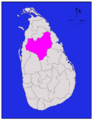
Area map of Anuradhapura District, located somewhat to the north of the centre of the country, in the North Central Province of Sri Lanka North Central Anuradhapura 6,664 (2,573) 515 (199) 7,179 (2,772) 856,232 128 (330)
Badulla Area map of Badulla District which has its northern border near the centre of the country and extends to the south, located in the Uva Province of Sri Lanka Uva Badulla 2,827 (1,092) 34 (13) 2,861 (1,105) 811,758 287 (740)
Batticaloa 
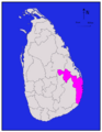
Area map of Batticaloa District, located along the east by north coast, in the Eastern Province of Sri Lanka Eastern Batticaloa 2,610 (1,010) 244 (94) 2,854 (1,102) 525,142 201 (520)
Colombo Area map of Colombo District, roughly rectangular in shape and extending inwards from the west south west coast in the Western Province of Sri Lanka Western Colombo 676 (261) 23 (8.9) 699 (270) 2,309,809 3,417 (8,850)
Galle 
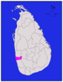
Area map of Galle District, converging inwards from the south west coast, in the Southern Province of Sri Lanka Southern Galle 1,617 (624) 35 (14) 1,652 (638) 1,058,771 655 (1,700)
Gampaha 
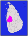
Area map of Gampaha District, extending inwards from the west by south west coast in a rough square shape, in the Western Province of Sri Lanka Western Gampaha 1,341 (518) 46 (18) 1,387 (536) 2,294,641 1,711 (4,430)
Hambantota 
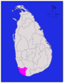
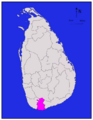
Area map of Hambantota District, lying along the coast from south to south east, in the Southern Province of Sri Lanka Southern Hambantota 2,496 (964) 113 (44) 2,609 (1,007) 596,617 239 (620)
Jaffna 
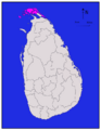
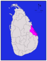
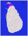
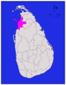
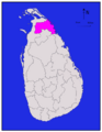
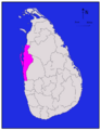
Area map of Jaffna District, in the peninsula to the north, in the Northern Province of Sri Lanka Northern Jaffna 929 (359) 96 (37) 1,025 (396) 583,378 628 (1,630)
Kalutara Area map of Kalutara District, extending inwards from the south west by west coast, in the Western Province of Sri Lanka Western Kalutara 1,576 (608) 22 (8.5) 1,598 (617) 1,217,260 772 (2,000)
Kandy Area map of Kandy District, at the centre of the country with its south western boundary extending to the south, in the Central Province of Sri Lanka Central Kandy 1,917 (740) 23 (8.9) 1,940 (750) 1,369,899 715 (1,850)
Kegalle Area map of Kegalle District, roughly oval in shape is located to the south east of the centre of the country, in the Sabaragamuwa Province of Sri Lanka Sabaragamuwa Kegalle 1,685 (651) 8 (3.1) 1,693 (654) 836,603 497 (1,290)
Kilinochchi Area map of Kilinochchi District, along the northern coast of the mainland and south of the Jaffna peninsula, in the Northern Province of Sri Lanka Northern Kilinochchi 1,205 (465) 74 (29) 1,279 (494) 112,875 94 (240)
Kurunegala 
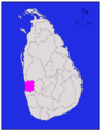
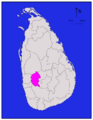
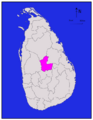
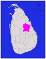
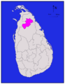
Area map of Kurunegala District, to the west of the centre of the country with its northern border extending towards the north west, in the North Western Province of Sri Lanka North Western Kurunegala 4,624 (1,785) 192 (74) 4,816 (1,859) 1,610,299 348 (900)
Mannar 
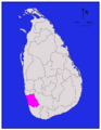
Area map of Mannar District, along the north western coast with eastern border extending towards the interior, also including a large island roughly oval in shape, in the Northern Province of Sri Lanka Northern Mannar 1,880 (730) 116 (45) 1,996 (771) 99,051 53 (140)
Matale 
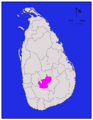
Area map of Matale District, located immediately north of the middle of the country, roughly the shape of a letter "C" and located in the Central Province of Sri Lanka Central Matale 1,952 (754) 41 (16) 1,993 (770) 482,229 247 (640)
Matara Area map of Matara District, roughly rectangular in shape and extending inwards from the southern coast, in the Southern Province of Sri Lanka Southern Matara 1,270 (490) 13 (5.0) 1,283 (495) 809,344 637 (1,650)
Moneragala 
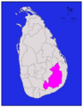
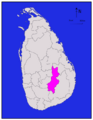
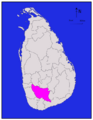
Area map of Moneragala District, located east of the centre of the country, has its south eat border extending towards the west, in the Uva Province of Sri Lanka Uva Moneragala 5,508 (2,127) 131 (51) 5,639 (2,177) 448,142 81 (210)
Mullaitivu Area map of Mullaitivu District, extending to the west from the north by east coast in the Northern Province of Sri Lanka Northern Mullaitivu 2,415 (932) 202 (78) 2,617 (1,010) 91,947 38 (98)
Nuwara Eliya Area map of Nuwara Eliya District, located immediately south of the middle of the country and running roughly south west to north east, in the Central Province of Sri Lanka Central Nuwara Eliya 1,706 (659) 35 (14) 1,741 (672) 706,588 414 (1,070)
Polonnaruwa 
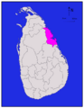
Area map of Polonnaruwa District, roughly square in shape, located at the middle from north east of the centre of the country and south west of the north eastern coast, in the North Central Province of Sri Lanka North Central Polonnaruwa 3,077 (1,188) 216 (83) 3,293 (1,271) 403,335 131 (340)
Puttalam Area map of Puttalam District, lying along the western coast, in the North Western Province of Sri Lanka North Western Puttalam 2,882 (1,113) 190 (73) 3,072 (1,186) 759,776 264 (680)
Ratnapura Area map of Ratnapura District, some distance from the south western coast with its western and southern borders converging towards the north west, in the Sabaragamuwa Province of Sri Lanka Sabaragamuwa Ratnapura 3,236 (1,249) 39 (15) 3,275 (1,264) 1,082,277 334 (870)
Trincomalee 
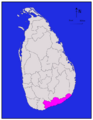
Area map of Trincomalee District, along the north eastern coast with its south western border extending inwards, in the Eastern Province of Sri Lanka Eastern Trincomalee 2,529 (976) 198 (76) 2,727 (1,053) 378,182 150 (390)
Vavuniya Area map of Vavuniya District, located in the middle of the northern half of the country, running roughly in a south west—north east direction, in the Northern Province of Sri Lanka Northern Vavuniya 1,861 (719) 106 (41) 1,967 (759) 171,511 92 (240)
Total 62,705 (24,211) 2,905 (1,122) 65,610 (25,330) 20,263,723 323 (840)
kids search engine
Districts of Sri Lanka Facts for Kids. Kiddle Encyclopedia.