Dock Tarn facts for kids
Quick facts for kids Dock Tarn |
|
|---|---|

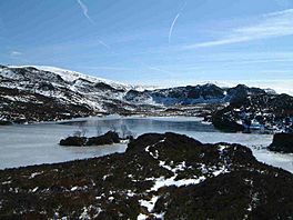
The frozen tarn with the small island in view
|
|
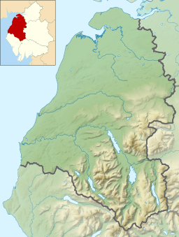
| Location | Lake District, Cumbria |
| Coordinates | 54°31′08″N 3°07′29″W / 54.51876°N 3.12460°W |
| Basin countries | United Kingdom |
| Surface elevation | 400 m (1,300 ft) |
Dock Tarn is a beautiful, small lake found in the amazing Lake District National Park in Cumbria, England. It is a quiet and peaceful spot, loved by many who visit the area. This special tarn sits high up on the moorland, which is a type of open, wild land.
Contents
Discovering Dock Tarn's Beauty
Dock Tarn is located about 400 meters (or 1,312 feet) above sea level. You can find it near the top of a hill called Great Crag. It's right in the middle of three interesting places: Watendlath, the Stonethwaite valley, and Borrowdale.
Size and Features of the Tarn
Dock Tarn is not very big. It measures about 300 meters (984 feet) long and 200 meters (656 feet) wide. The edge of the lake is not smooth. Instead, it has many rocky points and small bays, which are like little coves.
There is also a tiny island in the middle of the tarn. On this island, you can see a few small Rowan trees growing. Many writers who love the Lake District say that Dock Tarn is one of the most beautiful and peaceful places to visit. They also enjoy the walk to get there.
How to Reach Dock Tarn
Getting to Dock Tarn is an adventure in itself. There are a couple of main paths you can take. Both offer great views and a chance to explore the natural beauty of the Lake District.
Walking from Watendlath
One popular way to reach Dock Tarn is by walking from a village called Watendlath. This walk is about 2.5 kilometers (1.5 miles) long. The path goes uphill and gets very close to the top of Great Crag. Many hikers like to climb to the very summit of Great Crag as part of their trip.
Walking from Stonethwaite
Another way to get to the tarn is from the village of Stonethwaite. This path is about the same distance as the one from Watendlath. However, it can be a bit harder. The trail goes steeply through a forest with deciduous trees. These are trees that lose their leaves in the autumn. After the forest, you follow a stream called Willygrass Gill. This stream is actually the water flowing out of Dock Tarn.
 | John T. Biggers |
 | Thomas Blackshear |
 | Mark Bradford |
 | Beverly Buchanan |


