
Dodges Ferry facts for kids
Quick facts for kids Dodges FerryHobart, Tasmania |
|||||||||||||||
|---|---|---|---|---|---|---|---|---|---|---|---|---|---|---|---|

Dodges Ferry
Location in Hobart
|
|||||||||||||||
| Population | 2,467 (2016 census) | ||||||||||||||
| Postcode(s) | 7173 | ||||||||||||||
| Location | |||||||||||||||
| LGA(s) | Sorell Council | ||||||||||||||
| Region | South-east | ||||||||||||||
| State electorate(s) | Lyons | ||||||||||||||
| Federal Division(s) | Lyons | ||||||||||||||
|
|||||||||||||||
Dodges Ferry is a lovely coastal town in Tasmania, Australia. It's part of the Sorell area. This town is about 13 kilometers (about 8 miles) south-east of Sorell. In 2016, around 2,467 people called Dodges Ferry home.
Contents
A Glimpse into Dodges Ferry's Past
Dodges Ferry officially became a recognized place in 1966. But its story goes back much further! The town is named after a man named Ralph Dodge. He lived from 1791 to 1871. Ralph Dodge started a ferry service in the 1820s. This ferry helped people cross the Pittwater estuary.
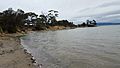
For a long time, Dodges Ferry was a super popular holiday spot. Tasmanians loved coming here for fun water activities. It's famous for its beautiful beaches like Frederick Henry Bay, Tiger Head Beach, and Park Beach. People enjoy safe swimming, fishing, and boating. Park Beach is also a great spot for surfing! On warm days, many people still visit to enjoy the coast.
Since the 1960s, more and more people started living in Dodges Ferry permanently. It changed from a town mostly for holiday shacks to a real residential town.
Where is Dodges Ferry?
Dodges Ferry is located right on the coast. The waters of Frederick Henry Bay form its western and southern edges. This bay is a large, beautiful body of water.
Getting Around Dodges Ferry
The main road that runs through Dodges Ferry is called Route C334. This road includes Old Forcett Road and Carlton River Road. It helps people travel from the north-west part of town to the east.

Images for kids
-

Okines beach
-
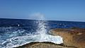
Okines beach water spray
-
Okines Beach
-
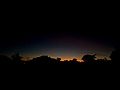
Night falling in Dodges Ferry
-
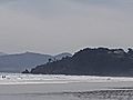
Foggy days on Okines Beach


