Doe Run Creek (Ararat River tributary) facts for kids
Quick facts for kids Doe Run Creek |
|
|---|---|
|
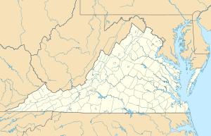
Location of Doe Run Creek mouth
|
|
| Other name(s) | Tributary to Ararat River |
| Country | United States |
| State | Virginia |
| County | Patrick |
| Physical characteristics | |
| Main source | Johnson Creek divide about 2 miles west of Groundhog Mountain peak 2,500 ft (760 m) 36°38′31″N 080°33′14″W / 36.64194°N 80.55389°W |
| River mouth | Ararat River about 1 mile northwest of The Hollow, Virginia 1,188 ft (362 m) 36°35′25″N 080°32′56″W / 36.59028°N 80.54889°W |
| Length | 3.78 mi (6.08 km) |
| Basin features | |
| Progression | south |
| River system | Yadkin River |
| Basin size | 2.63 square miles (6.8 km2) |
| Tributaries |
|
| Bridges | Logan Bluff, Youngs View Trail, Green Spring Road, Friends Mission Road |
Doe Run Creek is a small stream located in Patrick County, Virginia, in the United States. It flows for about 3.73 miles (6.00 kilometers). This creek is known as a "first-order tributary." This means it's one of the smallest streams that flows into a larger river. Doe Run Creek eventually joins the Ararat River.
Contents
All About Doe Run Creek
Doe Run Creek is an important part of the local water system. It helps carry water from higher elevations down to larger rivers.
Where Does It Begin?
Doe Run Creek starts in Patrick County, Virginia. Its source is near the Johnson Creek divide. This spot is about 2 miles (3.2 km) west of the Groundhog Mountain peak. The creek begins at an elevation of about 2,500 feet (762 meters) above sea level.
Its Journey Downstream
From its starting point, Doe Run Creek flows generally towards the south. It travels through the landscape, collecting water from smaller unnamed streams along its path. The creek's journey ends when it flows into the Ararat River. This meeting point is about 1 mile (1.6 km) northwest of a place called The Hollow, Virginia. At its mouth, the creek is about 1,188 feet (362 meters) above sea level.
The Land Around the Creek
The area that Doe Run Creek drains is called its watershed. This watershed covers about 2.63 square miles (6.81 square kilometers). The land here receives a good amount of rain and snow, about 50.5 inches (128 cm) each year. Much of this area, about 73%, is covered by forests. This helps keep the water clean and supports local wildlife.
Other Names for the Creek
Sometimes, creeks and rivers have different names over time. According to the Geographic Names Information System, Doe Run Creek has also been known by another name in the past:
- Doe Run Baptist Church
 | Audre Lorde |
 | John Berry Meachum |
 | Ferdinand Lee Barnett |


