Donnelly, Alaska facts for kids
Quick facts for kids
Donnelly
|
|
|---|---|
| Country | United States |
| State | Alaska |
| Census area | Southeast Fairbanks |
| Elevation | 1,785 ft (544 m) |
| Time zone | UTC-9 (Alaska (AKST)) |
| • Summer (DST) | UTC-8 (AKDT) |
| GNIS feature ID | 1401340 |
Donnelly is a small place in Alaska, United States. It is not a city with its own government. Instead, it is called an unincorporated community. This means it is a group of homes or buildings without an official town council.
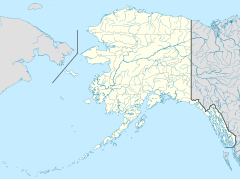
Donnelly is located in the Southeast Fairbanks Census Area. It sits high up, about 1,785 feet (544 meters) above sea level. You can find it along the Richardson Highway, which is a main road in Alaska. It is about 26 miles (42 kilometers) south of a town called Delta Junction.
How Did Donnelly Begin?
Donnelly was started around the year 1904. It began as a telegraph station. A telegraph station was a place where people sent messages over long distances. They used electric signals through wires. This station helped connect two other places: Chitina and Fairbanks.
In its early days, the buildings in Donnelly were mostly log cabins. These were simple homes and structures made from tree trunks. This was a common way to build in the Alaskan wilderness.
Donnelly's Population Story
| Historical population | |||
|---|---|---|---|
| Census | Pop. | %± | |
| 1970 | 7 | — | |
| U.S. Decennial Census | |||
Donnelly became an official city on December 15, 1960. This happened too late for it to be counted in the 1960 U.S. Census. A census is like a big count of all the people living in a country.
Donnelly only appeared once on the U.S. Census. This was in 1970. At that time, only seven people lived there. Because so few people lived in Donnelly, it was no longer considered an active city.
On March 7, 1974, Donnelly was officially dissolved as a city. This means it stopped being an official city. It has not been counted in the census since then. Today, it remains a small, unincorporated community.


