Dorset Cursus facts for kids
The Dorset Cursus is a very old monument from the Neolithic period. It stretches for about 10 kilometers (6¼ miles) across the chalk hills of Cranborne Chase in east Dorset, United Kingdom. This makes it one of the longest cursus monuments ever found. It's actually thought to be two cursus monuments built one after the other. The southern part, called the Gussage Cursus, was built first. The northern part, the Pentridge Cursus, was added later.
What is the Dorset Cursus?
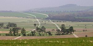
Not much of the Dorset Cursus can be seen above ground today. It once ran for 10 km (6¼ miles) through the rolling hills of Cranborne Chase in east Dorset. It goes from Martin Down to Thickthorn Down. This cursus is much bigger than other similar ancient sites. For example, it's over three times longer than the famous Great Cursus near Stonehenge.
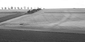
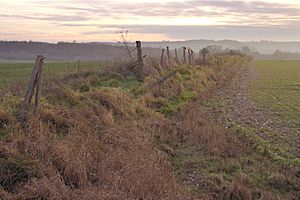
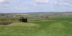
Most of what we know about the Dorset Cursus comes from looking at it from the air. Its path can be seen as cropmarks or soilmarks in fields. Scientists also use other special tools to map it underground. However, there are a few places where parts of the banks are still visible. The best-preserved parts are at the southwestern end on Thickthorn Down.
How old is it?
The Dorset Cursus was built around 3300 BCE. This means it's from the same time as the earthen long barrows found on Cranborne Chase. Many of these long barrows are found near or even on the Cursus itself. Since these barrows are still visible, they help us trace the Cursus's path today.
The way the Cursus lines up with these barrows suggests they were important for the same ritual or spiritual reasons. The people who built the Cursus spent a huge amount of time on it. Experts believe it took about half a million hours of work to build this massive monument.
How was it built?
The Cursus was made of two parallel banks. These banks were about 1.5 meters (5 feet) tall. They ran about 82 meters (270 feet) apart. On the outside of each bank, there were ditches about 1.5 meters (5 feet) deep and 2 meters (6.5 feet) wide. One bank is very straight, while the other one curves a bit. This suggests that the straight bank was built first. Then, the other bank was dug using the first one as a guide.
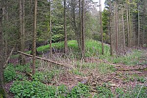
You can still see parts of these banks inside Salisbury Plantation on Oakley Down. A long barrow is even built into the northwest bank there. A 250-meter (820-foot) section of the southeast bank also remains on Bottlebush Down. This part is at a right angle to the B3081 road.
The banks were connected at their ends by cross-banks. Only the southwestern end bank on Thickthorn Down is still there. The northeastern end on Martin Down has been destroyed by farming over many centuries.
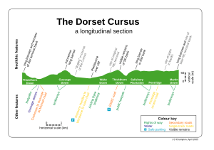
The Cursus generally runs from northeast to southwest. It's not a perfectly straight line. Instead, it has several straight parts that change direction slightly. It's believed that the Cursus was built in two main stages. First, the 5.6 km (3.5 miles) southwestern part was built. This section goes from Thickthorn Down to Bottlebush Down and is sometimes called the Gussage Cursus. Later, another 4.3 km (2.7 miles) was added to the northeast. This extended the Cursus from Bottlebush Down to Martin Down.
The Cursus doesn't follow the shape of the land. It goes up and down hills. The Gussage Cursus part is quite balanced. It has the Gussage Down ridge in the middle, with river valleys on both sides. The ends are near the tops of nearby ridges. The later Pentridge Cursus crosses one steep valley. After that, it follows the curves of the land more gently towards Martin Down.
 | Selma Burke |
 | Pauline Powell Burns |
 | Frederick J. Brown |
 | Robert Blackburn |


