Eabametoong First Nation facts for kids
Quick facts for kids
Eabametoong First Nation,
ᐊᐸᒪᑐᒃ ᐊᓂᔑᓇᐯ ᑕᔑᑫᐎᓐ
|
|||
|---|---|---|---|
| Fort Hope Indian Reserve No. 64 Eabamet Lake - (post office) |
|||
|
|||
| Motto(s):
As long at the sun shines, the grass grows, the river flows we are an Ojibway Nation
|
|||
| Country | Canada | ||
| Province | Ontario | ||
| Provincial Territorial Organization | Nishnawbe Aski Nation | ||
| District | Kenora | ||
| Tribal Council | Matawa First Nations | ||
| First Nation | Eabametoong First Nation | ||
| Government | |||
| • Type | Chief and Council | ||
| Area | |||
| • Land | 244.29 km2 (94.32 sq mi) | ||
| Elevation
Elevation at the airport
|
274 m (899 ft) | ||
| Population
(2021)
|
|||
| • Total | 977 | ||
| • Density | 4.1/km2 (11/sq mi) | ||
| Time zone | UTC−05:00 (EST) | ||
| • Summer (DST) | UTC−04:00 (EDT) | ||
| Postal Code |
P0T 1L0
|
||
| Area code(s) | 807 | ||
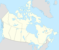
Eabametoong, also called Fort Hope, is a community in Ontario, Canada. It is home to the Eabametoong First Nation, an Ojibwe Indigenous group. This community is found on the shore of Eabamet Lake. It's about 300 kilometers northeast of Thunder Bay. You can reach Eabametoong by airplane, by boat, or by special winter/ice roads. These roads connect the community to the Northern Ontario Resource Trail. The Eabametoong First Nation Reserve is surrounded by the Unorganized Kenora District.
Contents
- Discovering Eabametoong's Past
- Eabametoong's Community and People
- Geography and Weather in Eabametoong
- Resources and Mining in the Ring of Fire
- Learning and Education
- Places to Visit and Things to Do
- Language and Culture
- Sports and Recreation
- Getting Around Eabametoong
- Media and Communication
- Notable People from Eabametoong
Discovering Eabametoong's Past
Eabametoong's story began during the fur trade era. The Hudson's Bay Company set up a trading post here in 1890. They chose this spot by Eabamet Lake because canoes were the main way to travel. Being near water was very important for trade.
The Fort Hope Band was officially formed in 1905. This happened when Treaty 9 was signed. A new chief and eight council members represented the community. The modern community of Eabametoong started in 1982. It officially became the Eabametoong First Nation in 1985. Before the fur trade, people were drawn to the area for its many fish. These included sturgeon, walleye, and whitefish, which are still found there today.
In 2016, the community center was damaged by fire. A new center has since been built. In 2017, the First Nation received money to help develop a farm. This farm helps create jobs and teaches new skills. It also provides fresh food for the community. The Eabametoong Farm has grown and even won an award. They plan to add greenhouses in the future.
What Does Eabametoong Mean?
The name Eabametoong has a special meaning in the Anishinaabe language. It means "at the reversing of the waterplace." This refers to how the water flow from Eabamet Lake into the Albany River changes. For a short time each year, especially after spring snow melts, water flows into the lake from the river.
Eabametoong's Community and People
| Historical populations | ||
|---|---|---|
| Year | Pop. | ±% |
| 1991 | 453 | — |
| 1996 | 801 | +76.8% |
| 2001 | 1,001 | +25.0% |
| 2006 | 1,144 | +14.3% |
| 2011 | 1,072 | −6.3% |
| 2016 | 1,014 | −5.4% |
| 2021 | 977 | −3.6% |
The Eabametoong First Nation has about 2,190 members. Around 1,300 of these members live in the community itself. The total number of people living on the reserve includes others too. This can be teachers, nurses, and members from other First Nations. The average home has about 4.3 people. Many homes have five or more residents.
| Age | Population | Percentage |
|---|---|---|
| 0-14 | 385 | 37.9 |
| 15-64 | 585 | 57.6 |
| 65+ | 35 | 3.4 |
| 85+ | 5 | 0.5 |
| Total | 1015 | 100 |
Source: Statistics Canada
Geography and Weather in Eabametoong
The community of Eabametoong First Nation, also known as Fort Hope, is located on the north shore of Eabamet Lake. This lake is part of the larger Albany River system.
Understanding Eabametoong's Climate
Fort Hope has a type of weather called a humid continental climate. This means it has cold winters. The summers are warm but short, and it often rains.
| Climate data for Fort Hope | |||||||||||||
|---|---|---|---|---|---|---|---|---|---|---|---|---|---|
| Month | Jan | Feb | Mar | Apr | May | Jun | Jul | Aug | Sep | Oct | Nov | Dec | Year |
| Mean daily maximum °C (°F) | −12.0 (10.4) |
−9 (16) |
−4 (25) |
5 (41) |
16 (61) |
22 (72) |
25 (77) |
24 (75) |
17 (63) |
8 (46) |
−1 (30) |
−9 (16) |
6.8 (44.4) |
| Mean daily minimum °C (°F) | −23 (−9) |
−21 (−6) |
−14 (7) |
−4 (25) |
4.0 (39.2) |
10 (50) |
14 (57) |
12 (54) |
7.0 (44.6) |
0 (32) |
−8 (18) |
−18 (0) |
−3.4 (26.0) |
| Average precipitation mm (inches) | 23 (0.9) |
19 (0.7) |
32 (1.3) |
43 (1.7) |
68 (2.7) |
78 (3.1) |
79 (3.1) |
58 (2.3) |
74 (2.9) |
63 (2.5) |
47 (1.9) |
28 (1.1) |
612 (24.2) |
| Average precipitation days (≥ 0.2 mm) | 10.2 | 8.6 | 18.9 | 12.9 | 17 | 16.8 | 20.6 | 18.5 | 12.2 | 12.3 | 12.4 | 11.3 | 171.7 |
| Average snowy days (≥ 0.2 cm) | 10 | 8.4 | 9.5 | 5 | 1.2 | 0.0 | 0.0 | 0.0 | 0.1 | 3.3 | 9.3 | 11 | 57.8 |
| Source: Meteoblue | |||||||||||||
Resources and Mining in the Ring of Fire
Eabametoong is one of the First Nations communities with traditional lands in the Ring of Fire. This area is known for its valuable minerals. Eabametoong and Neskantaga Indigenous communities have asked the province to "re-set" the process for mining development. They want to make sure their voices are heard and they are properly consulted.
A court decision in 2018 made it clear. Mining companies and the government must talk to First Nations, Inuit, and Métis communities. This must happen before any development that could affect their way of life. Eabametoong Chief Elizabeth Atlookan said this decision helps ensure proper procedures are followed.
Learning and Education
The John C Yesno Education Centre provides schooling for students. It teaches children from Junior Kindergarten up to Grade 9. The school was rebuilt in the late 1990s. It can hold up to 289 students. Students who want to continue their education after Grade 9 often go to schools in Thunder Bay, Sioux Lookout, or other places.
The school is modern and has good equipment. It includes two computer labs and a library with a Smart Board. There is also a science lab, a weight room, a woodworking shop, and a kitchen. In early 2024, the school was unfortunately damaged by fire.
Places to Visit and Things to Do
Miminiska is a special tourist camp. You can get there by plane or by boat on the Albany River. Every autumn, hunters from Eabametoong fly to Miminiska. They go there to hunt moose and catch sturgeon with nets.
The original settlement of Fort Hope is now called Old Fort Hope. It is located on Eabamet Lake, west of the current town. Two churches, a Catholic and an Anglican, are still standing there. You can reach Old Fort Hope by boat in the summer. In winter, you can use a snowmobile when the lake is frozen.
For fun and activities, Eabametoong has several facilities. These include an arena, a community hall, and Pow-wow grounds. There are also recreational trails and places to swim. The school has a gymnasium that can be used in the evenings and on weekends. It also has sports fields and playgrounds.
Language and Culture
Most of the older people in Eabametoong speak or understand Ojibway. To help keep the language alive, children are taught in both Ojibway and English. This happens at the John C Yesno Education Centre.
Sports and Recreation
Many people in Eabametoong enjoy being active. In the winter, hockey is very popular. The community is home to teams like the "Bush Town Jets," "Eabamet Lake Stealers," and "Eabametoong Trappers." There are also broomball tournaments at the local arena. In 2017, the John C Yesno Education Centre started the first girls' hockey team in Eabametoong. They even went to their first tournament in Thunder Bay.
In the summer, baseball is the favorite sport. In 2016, the JCY Wolves baseball team took part in two tournaments in Thunder Bay. They won both of them! It was the second year the school had sent a team to these tournaments.
Getting Around Eabametoong
The local roads within Eabametoong are taken care of by the First Nation. The airport and main streets are maintained by the Ontario Ministry of Transportation. In winter, a special road connects the community to the provincial highway system in Pickle Lake.
How to Travel to Eabametoong
Eabametoong can be reached by air all year round. There is a gravel airstrip at the Fort Hope Airport. It is about 3,500 feet long. There are regular and chartered flights. You can fly to Eabametoong from places like Thunder Bay, Sioux Lookout, and Nakina. There are also flights to other communities that can only be reached by air. Airlines that fly to Eabametoong include North Star, Wasaya, and Zaam. During warmer months, there are also places for floatplanes to dock.
In the winter, people also use snowmobiles and trails to travel between isolated communities.
Media and Communication
Eabametoong has two radio stations. One is CBC Radio, and the other is a Local Radio station (101.5 FM). Wawatay is also present in the community. Wawatay radio broadcasts over the local airwaves. The Wawatay newspaper is delivered every two weeks.
Notable People from Eabametoong
- Benjamin Chee Chee (1944–1977), a famous artist
- Ruby Slipperjack, an author and educator
 | Lonnie Johnson |
 | Granville Woods |
 | Lewis Howard Latimer |
 | James West |


