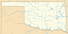
Eagle City, Oklahoma facts for kids
Quick facts for kids
Eagle City
|
|
|---|---|
| Country | United States |
| State | Oklahoma |
| County | Blaine |
| Area | |
| • Total | 0.67 sq mi (1.74 km2) |
| • Land | 0.67 sq mi (1.74 km2) |
| • Water | 0.00 sq mi (0.00 km2) |
| Elevation | 1,706 ft (520 m) |
| Population
(2020)
|
|
| • Total | 40 |
| • Density | 59.44/sq mi (22.94/km2) |
| Time zone | UTC-6 (Central (CST)) |
| • Summer (DST) | UTC-5 (CDT) |
| ZIP codes |
73658
|
| FIPS code | 40-22300 |
| GNIS feature ID | 2805314 |
Eagle City is a small community located in Blaine County, Oklahoma, in the United States. It is known as an unincorporated community, which means it doesn't have its own local government like a city or town. It is also a census-designated place, meaning the government counts its population for official records.
Eagle City is found along and west of State Highway 58. It was first established near a railroad line called the Frisco Line, even before Oklahoma became a state.
History of Eagle City
Eagle City started out with a different name. When its post office opened on July 26, 1902, it was called Dillon. A post office is a place where you can send and receive mail.
The name of the community was officially changed to Eagle City on September 4, 1909. Today, the ZIP Code for Eagle City is 73658. The closest post office for residents of Eagle City is now located in a nearby community called Oakwood.
Population Facts
Learning about the population helps us understand how many people live in a place. This is called demographics.
How Many People Live Here?
According to the 2020 United States Census, Eagle City had a population of 40 people. A census is like a big count of everyone living in a country, done every ten years.
| Historical population | |||
|---|---|---|---|
| Census | Pop. | %± | |
| 2020 | 40 | — | |
| U.S. Decennial Census | |||
 | Selma Burke |
 | Pauline Powell Burns |
 | Frederick J. Brown |
 | Robert Blackburn |


