East Coulee, Alberta facts for kids
Quick facts for kids
East Coulee
|
|
|---|---|
|
Former hamlet
|
|

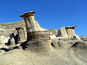
Hoodoos near East Coulee
|
|
| Country | Canada |
| Province | Alberta |
| Municipality | Town of Drumheller |
| Area | |
| • Land | 1.39 km2 (0.54 sq mi) |
| Elevation | 675 m (2,215 ft) |
| Population
(2016)
|
|
| • Total | 148 |
| Time zone | UTC−7 (MST) |
| • Summer (DST) | UTC−6 (MDT) |
| Area code(s) | 403, 587, 825 |
East Coulee is a small community in Alberta, Canada. It is part of the Town of Drumheller. Before 1998, East Coulee was a "hamlet," which is a small village. It joined with Drumheller on January 1, 1998.
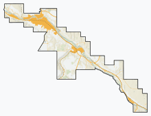
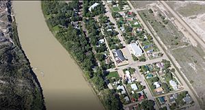
East Coulee is located on Alberta Highway 10. It is about 20 kilometers (12 miles) southeast of Drumheller. It is also about 112 kilometers (70 miles) northeast of Calgary. The community sits in the Red Deer River valley. Its elevation is 675 meters (2,215 feet) above sea level.
East Coulee was one of the places where the TV show MythQuest was filmed.
Contents
East Coulee: A Mining Town's Story
East Coulee was once a busy coal mining town. It had many people and businesses.
How East Coulee Grew and Shrank
Around 1930 and again in the mid-1940s, over 3,000 people lived in East Coulee. There were many shops and services. But by the mid-1950s, the number of people started to drop. Only three businesses were left: a hotel, a garage, and a grocery store. The community's school closed by 1970.
Why Coal Mining Ended
Like other coal towns, East Coulee's decline began in the 1950s. This was because new industries used oil and natural gas instead of coal. Also, many businesses switched from coal to other fuels. This meant less demand for coal from the Drumheller area.
Most coal mines in the area closed. Only the Atlas Mine in East Coulee stayed open. It kept going until 1979, but it was much smaller. It went from working all year to only part of the year. It also went from over 200 miners to just 60.
When the mine got smaller in the 1950s, many people left to find work elsewhere. This left many empty buildings and mines. It created a unique, quiet landscape in Alberta's badlands.
East Coulee's Population Changes
The number of people living in East Coulee has changed a lot over the years.
|
||||||||||||||||||||||||||||||||||||||||||||||||||||||
Recent Population Numbers
In the 2016 Census, 148 people lived in East Coulee. They lived in 87 homes out of 119 total homes. This was a small increase from 140 people in 2011. East Coulee has a land area of 1.39 square kilometers (0.54 square miles). In 2016, there were about 106 people per square kilometer.
In the 2011 Census, East Coulee had 140 people. They lived in 77 homes out of 95 total homes. This was a decrease of about 20.9% from 177 people in 2006. The land area in 2011 was 1.14 square kilometers (0.44 square miles).
 | Emma Amos |
 | Edward Mitchell Bannister |
 | Larry D. Alexander |
 | Ernie Barnes |


