East End, Arkansas facts for kids
Quick facts for kids
East End, Arkansas
|
|
|---|---|

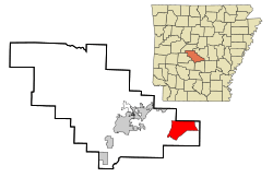
Location in Saline County and the state of Arkansas
|
|
| Country | United States |
| State | Arkansas |
| County | Saline |
| Area | |
| • Total | 20.28 sq mi (52.52 km2) |
| • Land | 20.06 sq mi (51.96 km2) |
| • Water | 0.21 sq mi (0.56 km2) |
| Elevation | 318 ft (97 m) |
| Population
(2020)
|
|
| • Total | 7,137 |
| • Density | 355.76/sq mi (137.36/km2) |
| Time zone | UTC-6 (Central (CST)) |
| • Summer (DST) | UTC-5 (CDT) |
| ZIP code |
72065,72206,and 72103
|
| Area code(s) | 501 |
| FIPS code | 05-20470 |
| GNIS feature ID | 2402426 |
East End is a special kind of community in Saline County, Arkansas, United States. It's called a census-designated place (CDP). This means it's a place that the government counts as a community for population numbers, but it doesn't have its own local government like a city or town.
In 2010, about 6,998 people lived in East End. By 2020, the population grew to 7,137 people. East End is part of the larger Little Rock area. This bigger area includes North Little Rock and Conway.
Where is East End Located?
East End is in Arkansas. It is close to several other communities. These include Landmark, Shannon Hills, Bauxite, and Sheridan.
The area of East End covers about 20.3 square miles (52.5 square kilometers). Most of this area is land, about 20.1 square miles (51.9 square kilometers). A small part, about 0.2 square miles (0.5 square kilometers), is water.
Since the 1950s, East End has been home to the Marylake Carmelite Monastery. This is a special place where monks live and pray.
How Many People Live in East End?
| Historical population | |||
|---|---|---|---|
| Census | Pop. | %± | |
| 2020 | 7,137 | — | |
| U.S. Decennial Census | |||
According to the 2020 United States census, there were 7,137 people living in East End. These people lived in 2,401 different homes. Out of these homes, 1,787 were families.
Schools in East End
The schools in East End are part of the Sheridan School District. Students in East End go to different schools depending on their age.
- East End Elementary School teaches students from kindergarten to second grade.
- East End Intermediate School is for students in third to fifth grades.
- East End Middle School serves students in sixth to eighth grades.
See also

- In Spanish: East End (Arkansas) para niños
 | Bessie Coleman |
 | Spann Watson |
 | Jill E. Brown |
 | Sherman W. White |

