Eastlake, Colorado facts for kids
Quick facts for kids
Eastlake, Colorado
|
|
|---|---|

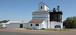
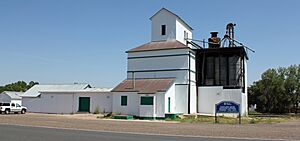
The Eastlake Farmers Co-Operative Elevator Company, located at 126th Avenue and Claude Court in the Eastlake Neighborhood of Thornton.
|
|
| Country | |
| State | |
| Counties | Adams |
| Elevation | 5,269 ft (1,606 m) |
| Time zone | UTC-7 (MST) |
| • Summer (DST) | UTC-6 (MDT) |
| ZIP code |
80241
|
Eastlake is a small place in Adams County, Colorado, United States. It is called an unincorporated community. This means it is not officially a city or town with its own local government. Instead, it is part of the larger county.
Eastlake also has a U.S. Post Office. This post office uses the ZIP Code 80614. A lot of the land that used to be Eastlake has now become part of the nearby City of Thornton.
The post office in Eastlake has been open since 1912. The community got its name from a lake nearby called East Lake.
Getting Around Eastlake
You can travel to Eastlake using public transportation. The N Line (RTD) is a train line that ends right here in Eastlake. This makes it easier for people to visit or commute.
Where is Eastlake?
Eastlake is located in Colorado. Its exact spot on a map is 39°55′17″N 104°57′33″W / 39.92139°N 104.95917°W. This location is about 1,606 meters (5,269 feet) above sea level.
 | Tommie Smith |
 | Simone Manuel |
 | Shani Davis |
 | Simone Biles |
 | Alice Coachman |


