El Chaltén facts for kids
Quick facts for kids
El Chaltén
|
|||
|---|---|---|---|

El Chaltén
|
|||
|
|||
| Country | |||
| Province | |||
| Department | Lago Argentino | ||
| Elevation | 410 metre m (410 metre ft) | ||
| Population
(2010)
|
|||
| • Total | 1,627 1,865 | ||
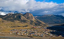
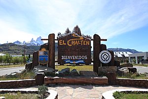
El Chaltén is a small mountain village in Santa Cruz Province, Argentina. It sits by the Rio de las Vueltas, inside the Los Glaciares National Park. The village is close to the famous mountain peaks of Cerro Torre and Cerro Fitz Roy. These tall, pointy mountains are very popular for climbing.
El Chaltén is also a great starting point for hiking. Many trails lead to the base of the surrounding peaks and beautiful glacial lakes. Two popular lakes are Laguna Torre and Laguna de los Tres, which is near the base of Fitz Roy. Because of all these amazing trails, El Chaltén is known as Argentina's Trekking Capital.
Today, the main reason El Chaltén exists is for tourism. In 1985, Argentina and Chile had a disagreement about who owned the land where El Chaltén is. In the end, there was no war, and El Chaltén became part of Argentina. Homes, government buildings, and flags were put up to show the town was settled.
The village is on the edge of the huge 12,363 km2 (4,773 sq mi) Southern Patagonian Ice Field. About 350 people live there all year round. Snow and ice often surround the town. The buildings are low, and many roads are made of rocks and dirt. In 2014, El Chaltén was ranked second in the travel guide Lonely Planet's 'Best in Travel' list. This was the first time an Argentine city made it onto their list!
Contents
What Does "Chaltén" Mean?
The word "Chaltén" comes from the Tehuelche language. It means smoking mountain. The Tehuelche people thought that Mount Chaltén was a volcano. This was because its peak is often covered by clouds, making it look like it was smoking.
In 1877, an Argentine explorer named Francisco Moreno gave the mountain another name: Mount Fitz Roy. He named it after Robert FitzRoy. FitzRoy was the captain of the ship HMS Beagle during its second voyage in the 1830s. El Chaltén has its own flag and coat of arms.
Exploring El Chaltén: Tourism and Activities
The village offers lots of information for visitors about the national park. You can find places to camp and a few beds to rent, mostly for backpackers. There are also some restaurants, bars, supermarkets, and shops. These shops sell and rent out a wide variety of outdoor gear.
When you go on treks outside the village, you can find free campsites. During the off-season, which is the southern hemisphere winter, many businesses might open for fewer hours or even close completely for months.
Other popular trails and sights nearby include the Torre Glacier, Laguna Capri, Piedras Blancas Glacier, and Chorrillo del Salto. The village also has a few restaurants and a cafe.
El Chaltén's Weather
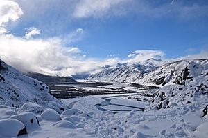
El Chaltén has a very changeable climate. It's often windy and cool, even in summer. The weather can be unpredictable, with rain or snow possible on many days.
Summers have long daylight hours, but it's usually very windy and cool. Daytime temperatures are mostly below 18 °C (64.4 °F), and nights are below 5 °C (41 °F). It can even freeze in the summer!
Winters bring a moderate amount of snow. Average daytime temperatures are around 3 °C (37.4 °F), and nights are about −4 °C (24.8 °F). However, the coldest nights can be much colder. Spring and fall weather can vary, but they are generally cold too.
| Climate data for El Chaltén (1941–1950) | |||||||||||||
|---|---|---|---|---|---|---|---|---|---|---|---|---|---|
| Month | Jan | Feb | Mar | Apr | May | Jun | Jul | Aug | Sep | Oct | Nov | Dec | Year |
| Record high °C (°F) | 30.3 (86.5) |
28.4 (83.1) |
25.6 (78.1) |
23.8 (74.8) |
20.4 (68.7) |
19.9 (67.8) |
17.5 (63.5) |
17.6 (63.7) |
19.5 (67.1) |
22.5 (72.5) |
25.2 (77.4) |
26.5 (79.7) |
30.3 (86.5) |
| Mean daily maximum °C (°F) | 18.0 (64.4) |
17.0 (62.6) |
14.7 (58.5) |
11.7 (53.1) |
6.6 (43.9) |
4.4 (39.9) |
4.3 (39.7) |
5.0 (41.0) |
7.9 (46.2) |
11.8 (53.2) |
13.9 (57.0) |
16.2 (61.2) |
11.0 (51.8) |
| Daily mean °C (°F) | 12.2 (54.0) |
11.4 (52.5) |
9.1 (48.4) |
6.4 (43.5) |
2.0 (35.6) |
0.0 (32.0) |
−0.1 (31.8) |
0.3 (32.5) |
2.5 (36.5) |
6.3 (43.3) |
8.4 (47.1) |
11.0 (51.8) |
5.8 (42.4) |
| Mean daily minimum °C (°F) | 7.8 (46.0) |
7.3 (45.1) |
4.6 (40.3) |
2.1 (35.8) |
−1.9 (28.6) |
−3.9 (25.0) |
−4.0 (24.8) |
−4.2 (24.4) |
−0.8 (30.6) |
2.6 (36.7) |
4.4 (39.9) |
7.1 (44.8) |
1.8 (35.2) |
| Record low °C (°F) | −1.5 (29.3) |
−2.5 (27.5) |
−3.3 (26.1) |
−13.0 (8.6) |
−14.5 (5.9) |
−20.2 (−4.4) |
−16.3 (2.7) |
−14.8 (5.4) |
−11.3 (11.7) |
−3.3 (26.1) |
−4.4 (24.1) |
−2.0 (28.4) |
−20.2 (−4.4) |
| Average precipitation mm (inches) | 58 (2.3) |
62 (2.4) |
67 (2.6) |
92 (3.6) |
92 (3.6) |
90 (3.5) |
73 (2.9) |
67 (2.6) |
49 (1.9) |
63 (2.5) |
45 (1.8) |
50 (2.0) |
808 (31.8) |
| Source: Sistema de Clasificación Bioclimática Mundial | |||||||||||||
Gallery
See also
 In Spanish: El Chaltén para niños
 | Emma Amos |
 | Edward Mitchell Bannister |
 | Larry D. Alexander |
 | Ernie Barnes |


