El Cuá facts for kids
Quick facts for kids
El Cuá
|
|
|---|---|
|
Municipality
|
|
| Country | |
| Department | Jinotega |
| Area | |
| • Municipality | 246 sq mi (637 km2) |
| Population
(2022 estimate)
|
|
| • Municipality | 61,689 |
| • Density | 250.82/sq mi (96.84/km2) |
| • Urban | 11,280 |
| Time zone | Central: UTC-6 |
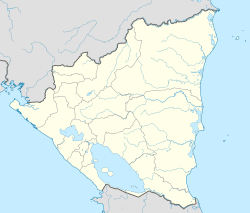
El Cuá is a municipality located in the Jinotega department of Nicaragua. A municipality is like a local government area, similar to a county or a large town. It used to be part of a bigger area called El Cuá-Bocay, but it became its own separate municipality in 2002. In 2022, about 61,689 people lived there.
During the 1980s, the area around El Cuá saw a lot of fighting during the Contra War. A special hydroelectric plant, which helps make electricity, was built here. This plant still provides power to El Cuá and the nearby town of San José de Bocay.
Contents
Exploring El Cuá's Geography
El Cuá is surrounded by other municipalities. To the north, it borders Wiwilí de Nueva Segovia and San José de Bocay. To the south, you'll find El Tuma-La Dalia and Rancho Grande. To the east are Waslala and Siuna, and to the west are Santa María de Pantasma and Jinotega.
Mountains and Rivers
This region has many mountains and lots of green plants. The land's height, or altitude, changes a lot. It can be as low as 300 meters (about 984 feet) above sea level near the Coco River. It goes up to 1,745 meters (about 5,725 feet) in the Peñas Blancas mountains and on Kilambé hill.
Many rivers flow all year round, which is great for making hydroelectric power. This means using the force of flowing water to create electricity. These rivers also have many fish and crustaceans, which are important food for the local people. Some of the biggest rivers include the Cua, Gusanera, Bocay, and Lakus rivers. The Coco or Segovia river is also very important, as it forms part of the border between Nicaragua and Honduras.
A Look at El Cuá's History
The first people to live in this area were called the Caribiés, who later became known as the Chontales. For a long time, until 1897, El Cuá was the main administrative center for the Bocay District.
When the Bocay district became part of the Jinotega department, the area of El Cuá was not very populated. However, it had many natural resources. The land of Cua-Bocay was part of the Jinotega municipality until 1989. That's when it became its own municipality, following a special law from the National Assembly of Nicaragua.
El Cuá's Climate
El Cuá has a tropical climate, which means it's warm all year. Temperatures usually stay between 24°C and 25°C (about 75°F to 77°F). The area gets a lot of rain, usually between 1,600 and 2,000 millimeters (about 63 to 79 inches) each year.
The wet season, when it rains the most, lasts for about eight months. The rest of the year is the dry season, with much less rain.
Communities in El Cuá
The municipality of El Cuá is divided into three main areas based on their physical features:
- South Zone: This area is called El Cuá. It includes 11 comarcas (which are like small rural districts) and 74 smaller communities.
- Central Zone: This area is called San José de Bocay. It has 12 comarcas and 63 communities.
- North Zone: This area is called Ayapal. It includes 13 comarcas and 50 communities.
Economy and Farming
The main way people make a living in El Cuá is through agriculture, which means farming. There are about 4,000 landowners in the area. Most of them are small farmers who have farms smaller than 20 Manzanas. A Manzana is a unit of land used in Nicaragua, and it's equal to about 1.74 acres. Farming is the most important way for families to support themselves.
See also
 In Spanish: El Cua para niños
 | Toni Morrison |
 | Barack Obama |
 | Martin Luther King Jr. |
 | Ralph Bunche |


