Tuma-La Dalia facts for kids
Quick facts for kids
El Tuma-La Dalia
|
|
|---|---|
|
Municipality
|
|
| Country | |
| Department | Matagalpa |
| Area | |
| • Municipality | 252 sq mi (652 km2) |
| Population
(2022 estimate)
|
|
| • Municipality | 79,740 |
| • Density | 316.76/sq mi (122.30/km2) |
| • Urban | 13,472 |
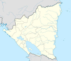
Tuma-La Dalia is a special area in Nicaragua called a municipality. It is found in the Matagalpa Department. The main town where the local government is located is called La Dalia.
This municipality gets its name from two important towns: El Tuma and La Dalia. It is about 175 kilometers (109 miles) away from Managua, which is the capital city of Nicaragua. It is also 45 kilometers (28 miles) from the city of Matagalpa.
Contents
Geography of Tuma-La Dalia
The area of Tuma-La Dalia has borders with several other places. To the north, it touches Jinotega and El Cuá. To the south, it borders Matiguás and San Ramón. On its east side is Rancho Grande, and to the west is the municipality of Matagalpa.
Most of this region is made up of mountains. You can still find parts of pine and cloud forests here. These forests are high up in the Darien and Isabelia mountain ranges. There are only a few flat areas, with some hills mixed in. About 40% of the land is flat, and 60% is rugged or mountainous.
History of Tuma-La Dalia
The story of this municipality began in the early 1920s. Back then, a new road connected the town of "El Tuma" to the city of Matagalpa. At that time, El Tuma was just a small group of scattered homes.
When people started growing a lot of coffee, more families moved to the area. Many people from Matagalpa came to start coffee farms, and these farms grew very well. In the 1960s, more families settled in a new town called "La Dalia." This town was an important meeting point between Wasaka and the "La Dalia" coffee estate.
On August 17, 1989, the country changed its political map. That's when El Tuma and La Dalia officially became one municipality, named El Tuma - La Dalia.
People of Tuma-La Dalia
Today, El Tuma - La Dalia has about 79,740 people living there. Out of everyone, about 49.8% are men and 50.2% are women. Around 16.9% of all the people live in the towns, while the rest live in the countryside.
Nature and Climate
The climate in Tuma-La Dalia is like a subtropical forest. It is semi-humid, meaning it gets a good amount of rain. The area usually receives between 2000 and 2500 millimeters (79 to 98 inches) of rain each year. The temperature stays pretty steady, usually between 22 and 24 °C (72 to 75 °F).
The land here has many different slopes. Some areas are gently rolling, while others are very steep mountains or even cliffs. The slopes can range from 8% to more than 75%.
Most of the land, about 62%, is used for growing forests. Another 17% is protected forest land. About 14% is used for agroforestry, which means growing trees and crops together. Only about 6% of the land is used for farming or for factories that process farm products.
Localities
The main town area of El Tuma - La Dalia is split into three neighborhoods. The countryside area has 26 different districts. Some of these districts include:
- Peñas Blancas
- Bijao Arriba
- Bull Bull Arriba
- Bull Bull Abajo
- Wasaka Arriba
- Wasaka Abajo
- El Pavón
- El Castillo
- La Tronca
- Yale
- El Granadillo
- El Coyolar
- El Tigre
- Piedra Luna
- Aguas Amarillas
- Quililito
- Quililon
- El Guapotal
- Yayule
- Yasica Norte y Cuatro Esquinas
- Wassaka Central
- Wassaka Southeast
Economy
The main way people make money in Tuma-La Dalia is through farming. Growing coffee is the most important economic activity here.
The municipality also has some interesting places to visit:
- The San Martín Hydroelectric Plant, which makes electricity from water.
- The Tuma River, a natural waterway.
- "El Edén" Waterfall, a beautiful natural waterfall.
- Agroecological coffee farms, where you can see how coffee is grown and processed.
See also
 In Spanish: El Tuma - La Dalia para niños
 | Valerie Thomas |
 | Frederick McKinley Jones |
 | George Edward Alcorn Jr. |
 | Thomas Mensah |


