
Embree Glacier facts for kids
Quick facts for kids Embree Glacier |
|
|---|---|

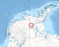
Location of Sentinel Range in Western Antarctica
|
|

Location in Antarctica
|
|
| Location | Ellsworth Land |
| Coordinates | 77°59′S 85°10′W / 77.983°S 85.167°W |
| Length | 20 nmi (37 km; 23 mi) |
| Thickness | unknown |
| Terminus | Rutford Ice Stream |
| Status | unknown |

The Embree Glacier is a large river of ice located in Antarctica. It stretches about 20 nautical miles (which is about 37 kilometers or 23 miles) long. This glacier is found in the middle of the northern part of the Sentinel Range in the Ellsworth Mountains.
Contents
What is Embree Glacier?
Embree Glacier is a massive, slow-moving body of ice. It collects ice from the eastern sides of mountains like Mount Hale, Mount Davis, and Mount Bentley. It also gathers ice from the northeast slopes of Mount Anderson and the northwest slopes of Probuda Ridge.
Where Does it Flow?
The glacier flows generally towards the north-northeast. As it moves past Mount Schmid, it turns east. Eventually, it joins a much larger ice stream called the Rutford Ice Stream, which is located east of Mount Tegge.
How Did it Get its Name?
The Embree Glacier was named by the US-ACAN, which stands for the United States Advisory Committee on Antarctic Names. It was named in honor of Major Henry Embree of the U.S. Air Force. Major Embree was important because he helped set up the South Pole Station in 1956. This station is a scientific research center at the geographic South Pole.
Location of Embree Glacier
The center of Embree Glacier is located at coordinates 77°59′00″S, 85°10′00″W. Maps of this area were first made by the United States in 1961 and then updated in 1988. This helps scientists and explorers know exactly where the glacier is.
Images for kids
-
Location of Sentinel Range in Western Antarctica
