Emerald Isle (Northwest Territories) facts for kids

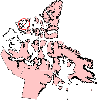
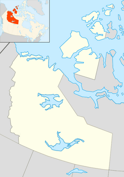
Emerald Isle, Northwest Territories.
|
|
| Geography | |
|---|---|
| Location | Northern Canada |
| Coordinates | 76°48′N 114°07′W / 76.800°N 114.117°W |
| Archipelago | Queen Elizabeth Islands Canadian Arctic Archipelago |
| Area | 549 km2 (212 sq mi) |
| Length | 36 km (22.4 mi) |
| Width | 22 km (13.7 mi) |
| Administration | |
|
Canada
|
|
| Territory | Northwest Territories |
| Demographics | |
| Population | Uninhabited |
Emerald Isle is a cool island located in the very cold northern part of Canada. It's one of the many Canadian Arctic islands, which are a group of islands found in the Arctic Ocean. Specifically, it's part of the Queen Elizabeth Islands, a large group of islands within the Arctic Archipelago.
This island belongs to the Northwest Territories, which is one of Canada's large northern areas. Emerald Isle is not very big, covering an area of 549 km2 (212 sq mi). It stretches about 36 kilometres (22 mi) long and 22 kilometres (14 mi) wide. No people live on Emerald Isle, making it a wild and untouched place in the Arctic.
Contents
Where is Emerald Isle Located?
Emerald Isle is found in the far north of Canada. It is part of the Queen Elizabeth Islands, which are the most northern islands in the Canadian Arctic Archipelago. These islands are known for their icy landscapes and very cold weather.
Part of the Northwest Territories
The island is officially part of the Northwest Territories. This territory is a huge area in northern Canada, famous for its vast wilderness, many lakes, and unique wildlife. The Northwest Territories is one of Canada's three territories, along with Yukon and Nunavut.
Size and Features of Emerald Isle
Emerald Isle might not be the biggest island, but it's still a significant piece of land in the Arctic. Its size helps us understand how much space it takes up in this remote part of the world.
How Big is Emerald Isle?
The island has a total area of 549 square kilometers (about 212 square miles). To give you an idea, that's roughly the size of a medium-sized city, but instead of buildings, it's mostly ice, rock, and tundra. It measures 36 kilometers (22 miles) from end to end and 22 kilometers (14 miles) across.
Is the Island Inhabited?
No, Emerald Isle is completely uninhabited. This means no people live there permanently. Because of its extreme northern location and harsh climate, it's not a place where humans can easily settle. This makes it an important area for wildlife that can survive in such cold conditions.
See also
 In Spanish: Isla Esmeralda (Canadá) para niños
 | Charles R. Drew |
 | Benjamin Banneker |
 | Jane C. Wright |
 | Roger Arliner Young |


