Emery Point Light facts for kids
 |
|
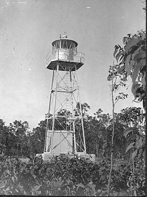
| Emery Point Light, 1915 | |
|
|
|
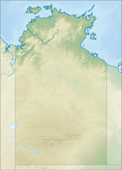
| Location | Larrakeyah Northern Territory Australia |
|---|---|
| Coordinates | 12°27′13.5″S 130°48′55.99″E / 12.453750°S 130.8155528°E |
| Year first constructed | 1900 |
| Year first lit | 1915 |
| Foundation | concrete base |
| Construction | metal skeletal tower |
| Tower shape | square pyramidal tower with balcony and lantern |
| Markings / pattern | white tower and lantern |
| Height | 31 feet (9.4 m) |
| Focal height | 60 feet (18 m) |
| Range | white: 19 nmi (35 km; 22 mi) red: 14 nmi (26 km; 16 mi) |
| Characteristic | Fl(3) WR 15s. |
| Admiralty number | K3324 |
| NGA number | 111-9528 |
| ARLHS number | AUS-071 |
The Emery Point Light is a working lighthouse in Australia. You can find it at Larrakeyah Barracks, which is a big military base in the Northern Territory. This lighthouse stands at the entrance to Port Darwin. It was the second lighthouse ever built in Port Darwin. What's really amazing is that it was the only navigation light that kept working when Cyclone Tracy hit!
Contents
History of the Emery Point Light
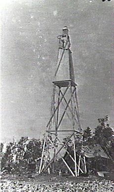
The very first light at Emery Point started shining in 1900. It was taken down in May 1915 to make way for the lighthouse you see today. The current lighthouse was put up later that same year. Building this lighthouse was part of a special time called the "Golden Age of Australian Lighthouses." This was when many important lighthouses were built across Australia, between 1913 and 1920.
When it first started, the light came from a carbide lamp. This lamp used acetylene gas to make its bright flame. On March 23, 1966, the lighthouse was changed to use electric power. It still had an acetylene gas lamp ready as a backup, just in case the electricity went out. Today, the light comes from a super bright 1,000 watt tungsten-halogen lamp.
Surviving Cyclone Tracy
On Christmas Eve in 1974, a very powerful storm called Cyclone Tracy hit the city of Darwin. This cyclone caused a lot of damage. But the Emery Point Light was incredibly strong. It was the only navigation light in the storm's path that kept working. This meant it could still guide ships safely even during the terrible weather.
How the Light Shines
Over the years, the way the light flashes has changed. At first, it was an "occulting light." This means the light would shine steadily and then go dark for 1.5 seconds, every six seconds. It could be seen from about 17 nmi away.
The light today flashes differently. It shows three quick flashes, one every two seconds. This pattern repeats every 15 seconds. The light also changes color depending on where you are looking from. It shines red in some directions and white in others. The red light can be seen from about 14 nmi away, and the white light can be seen from about 19 nmi away.
Naming Emery Point
The area where the lighthouse stands was originally called Goondal. It was later named Emery Point after a Lieutenant Emery. He was the person who discovered fresh water at the bottom of the cliff nearby.
Structure of the Lighthouse
The lighthouse tower you see today was built in 1915. It's made of a square metal frame, painted white. On top of the frame is the lantern, which holds the light. The tower itself is about 31 feet tall from its base to the top of the lantern. The light inside the lantern is about 60 feet above sea level. This height is called the "focal height."
Visiting and How it Works
The Emery Point Light and the land around it are part of a military base. This means that the public cannot visit the lighthouse or the tower up close. However, you can still see the lighthouse from the sea. The Darwin Port Corporation is in charge of operating and looking after this important light.
 | Bessie Coleman |
 | Spann Watson |
 | Jill E. Brown |
 | Sherman W. White |


