Encinacorba facts for kids
Quick facts for kids
Encinacorba
|
|||
|---|---|---|---|
 |
|||
|
|||
| Country | |||
| Autonomous community | |||
| Province | Zaragoza | ||
| Area | |||
| • Total | 36 km2 (14 sq mi) | ||
| Elevation | 762 m (2,500 ft) | ||
| Population
(2018)
|
|||
| • Total | 189 | ||
| • Density | 5.25/km2 (13.60/sq mi) | ||
| Time zone | UTC+1 (CET) | ||
| • Summer (DST) | UTC+2 (CEST) | ||
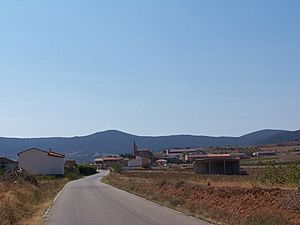
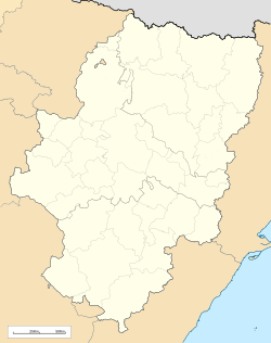
Encinacorba is a small town, also called a municipality, located in the province of Zaragoza. This province is part of the region of Aragon in Spain. In 2004, a count of people, called a census, showed that 294 people lived there. By 2018, the population was 189.
Where is Encinacorba?
Encinacorba is found near a mountain range called the Sierra de Algairén. It is also part of a larger area known as the Campo de Cariñena. This area is one of the many comarcas (or regions) within Aragon.
What is a Municipality?
A municipality is like a local government area. It includes a main town or village and the land around it. Encinacorba is one of many municipalities in Spain. Each municipality has its own local leaders who help manage the town.
See also
 In Spanish: Encinacorba para niños
Black History Month on Kiddle
Famous African-American Scientists:
 | Ernest Everett Just |
 | Mary Jackson |
 | Emmett Chappelle |
 | Marie Maynard Daly |

All content from Kiddle encyclopedia articles (including the article images and facts) can be freely used under Attribution-ShareAlike license, unless stated otherwise. Cite this article:
Encinacorba Facts for Kids. Kiddle Encyclopedia.


