Encinasola de los Comendadores facts for kids
Quick facts for kids
Encinasola de los Comendadores
|
|
|---|---|

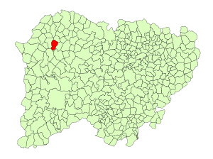
Location in Salamanca
|
|
| Country | Spain |
| Autonomous community | Castile and León |
| Province | Salamanca |
| Comarca | Vitigudino |
| Subcomarca | La Ramajería |
| Area | |
| • Total | 34 km2 (13 sq mi) |
| Elevation | 710 m (2,330 ft) |
| Population
(2018)
|
|
| • Total | 170 |
| • Density | 5.00/km2 (12.9/sq mi) |
| Time zone | UTC+1 (CET) |
| • Summer (DST) | UTC+2 (CEST) |
| Postal code |
37256
|
Encinasola de los Comendadores is a small village and municipality located in western Spain. It is part of the Salamanca province within the Castile and León region. This quiet place is about 96 kilometers (60 miles) from the city of Salamanca, which is the capital of the province. In 2018, about 170 people lived there.
Geography of Encinasola
Encinasola de los Comendadores covers an area of about 34 square kilometers (13 square miles). To give you an idea, that's roughly the size of 3,400 football fields! The village sits 710 meters (about 2,330 feet) above sea level. This means it's quite high up compared to the ocean. The postal code for Encinasola de los Comendadores is 37256. This code helps mail get to the right place.
Local Government
Like all municipalities in Spain, Encinasola de los Comendadores has its own local government. The main leader is called the Mayor. The current Mayor is Francisco Prieto Prieto, who belongs to the People's Party. The Mayor and the local council work together to manage the village, making decisions about things like public services and local events.
Images for kids
See also

- In Spanish: Encinasola de los Comendadores para niños


