
Ensenada, Guánica, Puerto Rico facts for kids
Quick facts for kids
Ensenada
|
|
|---|---|
|
Barrio
|
|

Seventh-day Adventist Church in Ensenada
|
|

Location of Ensenada within the municipality of Guánica shown in red
|
|

Ensenada, Guánica, Puerto Rico
Location in Caribbean
|
|
| Commonwealth | |
| Municipality | |
| Area | |
| • Total | 1.04 sq mi (2.7 km2) |
| • Land | 0.79 sq mi (2.0 km2) |
| • Water | 0.25 sq mi (0.6 km2) |
| Elevation | 7 ft (2 m) |
| Population
(2010)
|
|
| • Total | 1,705 |
| • Density | 2,158.2/sq mi (833.3/km2) |
| Source: 2010 Census | |
| Time zone | UTC−4 (AST) |
| ZIP Code |
00647
|
Ensenada Barrio is a small area, or barrio, located in the town of Guánica, Puerto Rico. In 2010, about 1,705 people lived there.
History of Ensenada
For many years, Ensenada's economy was all about sugar. It had a big sugar mill and a processing plant. When sugar was a huge business in Puerto Rico, Ensenada was very successful. Because of this success, the community even wanted to become its own separate town, not just a part of Guánica.
However, the sugar mill closed down in 1982. After that, the people of Ensenada decided to stay as part of the Guánica municipality.
There's a special old inn in Ensenada called the Parador Guánica. It was built way back in 1929. This inn is very strong! It survived the powerful 2019–20 Puerto Rico earthquakes. It even became a safe place for workers from the Federal Emergency Management Agency (FEMA) during that time.
Images for kids
-
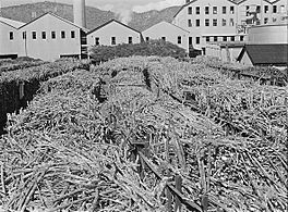
Photo by Jack Delano of "Ensenada, Guanica. Carloads of sugar cane at the South Puerto Rico Sugar Company" (c. January 1942)
-
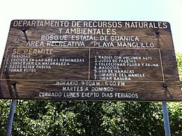
Sign for Manglillo Beach in Guánica
-
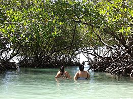
Women wading near mangroves in Manglillo Beach
-
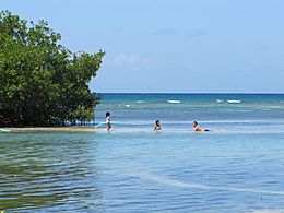
On a sandbar in Manglillo Beach


.jpg)
.jpg)
See also
 In Spanish: Ensenada (Guánica) para niños
