Erda, Utah facts for kids
Quick facts for kids
Erda, Utah
|
||
|---|---|---|
|
City
|
||

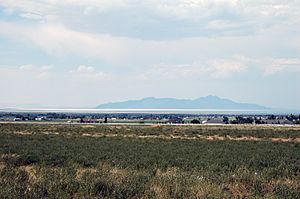
View of Erda looking at the Great Salt Lake and Stansbury Island
|
||
|
||

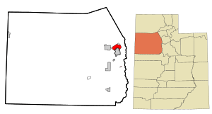
Location in Tooele County and the state of Utah
|
||

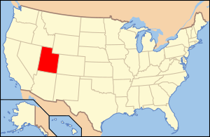
Location of Utah in the United States
|
||
| Country | United States | |
| State | Utah | |
| County | Tooele | |
| Established | 1852 | |
| Incorporated as a city | January 3, 2022 | |
| Area | ||
| • Total | 22.5 sq mi (58.2 km2) | |
| • Land | 22.5 sq mi (58.2 km2) | |
| • Water | 0.0 sq mi (0.0 km2) | |
| Elevation | 4,337 ft (1,322 m) | |
| Population
(2010)
|
||
| • Total | 4,642 | |
| • Density | 206.3/sq mi (79.76/km2) | |
| Time zone | UTC-7 (Mountain (MST)) | |
| • Summer (DST) | UTC-6 (MDT) | |
| ZIP code |
84074
|
|
| Area code(s) | 435 | |
| FIPS code | 49-23640 | |
| GNIS feature ID | 2830630 | |
Erda (pronounced UR-duh) is a city located in Tooele County, Utah, in the United States. In 2010, about 4,642 people lived there. This was a big jump from the 2,473 people counted in 2000. Erda used to be a special area called a "Census Designated Place" (CDP). It also used to be a township. But in January 2022, Erda officially became a city.
Contents
Geography and History of Erda
Erda is found just south of Stansbury Park. It is west of SR-36. The city is also north of Tooele, which is the main town of the county.
When Erda was a CDP, it covered about 22.5 square miles (58.2 square kilometers) of land. There was no water area within its borders. In the past, this community was known by other names. People used to call it Bates or Batesville.
People Living in Erda
The number of people living in Erda has changed over the years. Here is a quick look at its population:
| Historical population | |||
|---|---|---|---|
| Census | Pop. | %± | |
| 1880 | 145 | — | |
| 1890 | 117 | −19.3% | |
| 1900 | 183 | 56.4% | |
| 1910 | 188 | 2.7% | |
| 1920 | 183 | −2.7% | |
| 1930 | 151 | −17.5% | |
| 1940 | 188 | 24.5% | |
| 1950 | 118 | −37.2% | |
| 1990 | 1,113 | — | |
| 2000 | 2,473 | 122.2% | |
| 2010 | 4,642 | 87.7% | |
| 2020 | 3,673 | −20.9% | |
| source: | |||
In 2000, there were 2,473 people living in Erda. These people lived in 697 homes. Most of these homes (623) were families. About 54 out of every 100 homes had children under 18. Most families (81 out of 100) were married couples.
The people in Erda were mostly White (about 97%). A small number of people were from other racial backgrounds. About 4 out of every 100 people were of Hispanic or Latino origin. The average home had about 3.5 people.
The population of Erda is quite young. About 38% of the people were under 18 years old. The average age was 30 years. Most people were between 25 and 44 years old.
Churches and Schools in Erda
As of 2019, Erda had two churches. Both of these churches are meetinghouses for the Church of Jesus Christ of Latter-day Saints (LDS Church). They are both located on Erda Way. The LDS Church had planned to build a special building called a temple in Erda. However, some local residents had concerns. So, the temple location was moved to nearby Tooele.
In 2019, Erda had one school called Excelsior Academy. It is also on Erda Way. Excelsior Academy is a public charter school. This means it is free to attend. It serves students from kindergarten up to 8th grade. Other schools in Stansbury Park also serve students from the Erda area.
Transportation
Erda has an airport called Bolinder Field. It is also known as Tooele Valley Airport. You can find it at 4663 N. Airport Road in Erda.
See also
 In Spanish: Erda (Utah) para niños
 | Precious Adams |
 | Lauren Anderson |
 | Janet Collins |


