Espy, Pennsylvania facts for kids
Quick facts for kids
Espy, Pennsylvania
|
|
|---|---|

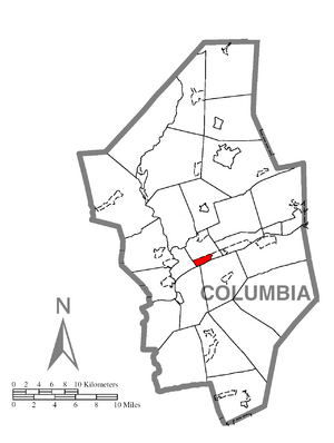
Location within Columbia County
|
|
| Country | United States |
| State | Pennsylvania |
| County | Columbia |
| Township | Scott |
| Area | |
| • Total | 1.10 sq mi (2.86 km2) |
| • Land | 0.90 sq mi (2.33 km2) |
| • Water | 0.20 sq mi (0.53 km2) |
| Elevation | 480 ft (150 m) |
| Population
(2020)
|
|
| • Total | 1,620 |
| • Density | 1,802.00/sq mi (695.61/km2) |
| Time zone | UTC-5 (Eastern (EST)) |
| • Summer (DST) | UTC-4 (EDT) |
| ZIP Code |
17815
|
| FIPS code | 42-24088 |
| GNIS feature ID | 1174322 |
Espy is a small community in Columbia County, Pennsylvania, United States. It is known as a census-designated place (CDP). This means it's an area that the U.S. Census Bureau defines for gathering population data. Espy is part of Northeastern Pennsylvania. In 2020, about 1,620 people lived there. Espy is also part of the larger Bloomsburg-Berwick area. It was first settled in the late 1700s. In the 1800s, it even had a place where boats were built!
Contents
History of Espy
Espy got its name from Josiah Espy, an early settler. He moved to the area in 1775. A few years later, in 1785, Josiah's son George also moved there.
In 1800, George Espy divided the land into smaller pieces. This created the town we know today as Espy. The town was first called Liberty. But in 1828, it was officially renamed Espy, honoring George Espy. The first hotel in Espy was built in 1805. There was once a boatyard in Espy, but it was destroyed in 1900.
Geography of Espy
Espy is located in the middle of Columbia County. You can find it at coordinates 41°0′21″N 76°24′54″W. It sits in the southwest part of Scott Township.
The community is surrounded by important landmarks. U.S. Route 11 is to the north. The Susquehanna River is to the south. Almedia is to the east. Bloomsburg, which is the county seat, is to the west and northwest.
Espy covers a total area of about 2.9 square kilometers (1.1 square miles). Most of this area, about 2.4 square kilometers (0.9 square miles), is land. The rest, about 0.5 square kilometers (0.2 square miles), is water. Espy is one of several small communities located along the north side of the Susquehanna River. These communities are found between Bloomsburg and Berwick.
Population and People
| Historical population | |||
|---|---|---|---|
| Census | Pop. | %± | |
| 2020 | 1,620 | — | |
| U.S. Decennial Census | |||
In 2020, Espy had a population of 1,620 people. Back in 2000, there were 1,428 people living in Espy. At that time, most residents were White. A small number of people were African American, Native American, or Asian. Some people identified as being from two or more races. About 1% of the population was Hispanic or Latino.
In 2000, about 19% of the population was under 18 years old. The median age was 43 years. This means half the people were younger than 43, and half were older.
The average income for a household in Espy in 2000 was $33,250. For families, the average income was $36,908.
Interestingly, in 2000, 2% of Espy residents said they had Egyptian heritage. This was a high percentage for any place in the country.
The most common family backgrounds in Espy include German, Irish, Dutch, American, British, and Italian.
Roads and Transportation
U.S. Route 11 runs along the northern edge of Espy. This road is important for getting around. It goes west about 2.5 miles (4 kilometers) to the center of Bloomsburg. It also goes about 11 miles (18 kilometers) to Danville. If you head east on Route 11, it's about 10 miles (16 kilometers) to Berwick.
Education in Espy
For higher education, Bloomsburg University of Pennsylvania is the closest large college to Espy. It has over 2,000 students. Children living in Espy attend schools within the Central Columbia School District.
See also
 In Spanish: Espy (Pensilvania) para niños
 | Selma Burke |
 | Pauline Powell Burns |
 | Frederick J. Brown |
 | Robert Blackburn |


