Esquipulas Palo Gordo facts for kids
Quick facts for kids
Esquipulas Palo Gordo
|
|
|---|---|
|
Municipality
|
|
 |
|
| Country | |
| Department | |
| Area | |
| • Municipality | 45 km2 (17 sq mi) |
| Population
(2018 census)
|
|
| • Municipality | 12,892 |
| • Density | 286/km2 (742/sq mi) |
| • Urban | 3,952 |
| Climate | Cwb |
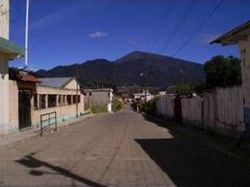
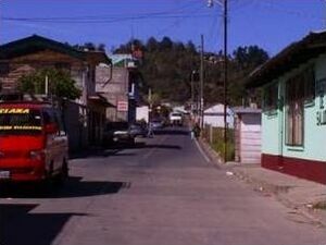
Esquipulas Palo Gordo is a town and a special area called a municipality in the San Marcos department of Guatemala. It's like a small local government area. The town was started a long time ago, on December 24, 1826. In the 1920s, it became part of another town called San Marcos. But in 1948, Esquipulas Palo Gordo became independent again.
Contents
Natural Resources and Farming
The area around Esquipulas Palo Gordo has many natural resources. People here mostly raise cattle, grow trees for wood, and farm. The land is very flat and good for growing crops.
Farmers in this municipality grow many important foods. Their main crops include sugar cane, corn, wheat, potatoes, and beans. These crops help feed the people living there.
Fun Things to Do and See
Esquipulas Palo Gordo has some beautiful natural places to visit. One of these is Ixtagel hill, which is a great spot for exploring. There is also a special place called the Quetzal refuge in Fraternidad village. This refuge helps protect the Quetzal, a beautiful bird.
About half of the municipality is covered in large forests. These forests are home to many different kinds of animals. The town also has a yearly fair to celebrate the Black Christ of Esquipulas. This fair happens between January 12 and 17 each year.
Weather and Climate
Esquipulas Palo Gordo has a mild and pleasant climate. It is known as a temperate climate. This means it usually has warm summers and cool winters.
| Climate data for Esquipulas Palo Gordo | |||||||||||||
|---|---|---|---|---|---|---|---|---|---|---|---|---|---|
| Month | Jan | Feb | Mar | Apr | May | Jun | Jul | Aug | Sep | Oct | Nov | Dec | Year |
| Mean daily maximum °C (°F) | 16.7 (62.1) |
17.1 (62.8) |
18.6 (65.5) |
19.5 (67.1) |
19.4 (66.9) |
18.7 (65.7) |
18.6 (65.5) |
19.1 (66.4) |
18.6 (65.5) |
17.8 (64.0) |
17.5 (63.5) |
17.0 (62.6) |
18.2 (64.8) |
| Daily mean °C (°F) | 9.2 (48.6) |
9.5 (49.1) |
11.0 (51.8) |
12.5 (54.5) |
13.7 (56.7) |
13.8 (56.8) |
13.6 (56.5) |
13.5 (56.3) |
13.7 (56.7) |
12.8 (55.0) |
11.2 (52.2) |
10.2 (50.4) |
12.1 (53.7) |
| Mean daily minimum °C (°F) | 1.8 (35.2) |
2.0 (35.6) |
3.4 (38.1) |
5.5 (41.9) |
8.1 (46.6) |
9.0 (48.2) |
8.7 (47.7) |
7.9 (46.2) |
8.8 (47.8) |
7.8 (46.0) |
4.9 (40.8) |
3.5 (38.3) |
6.0 (42.7) |
| Average precipitation mm (inches) | 6 (0.2) |
6 (0.2) |
25 (1.0) |
66 (2.6) |
227 (8.9) |
329 (13.0) |
237 (9.3) |
269 (10.6) |
342 (13.5) |
227 (8.9) |
28 (1.1) |
13 (0.5) |
1,775 (69.8) |
| Source: Climate-Data.org | |||||||||||||
Where Esquipulas Palo Gordo Is
You can get to Esquipulas Palo Gordo in two main ways. One way is to travel from Guatemala City to San Marcos. This journey is about 252 kilometers long on a main highway. Once you are in San Marcos, it is only a short 7.5 kilometer drive on a national road to reach Esquipulas Palo Gordo.
The municipality is surrounded by other towns in the San Marcos Department. Here is how it is located:
 |
San Marcos |  |
||
| San Rafael Pie de la Cuesta | San Marcos | |||
| San Pedro Sacatepéquez and El Tumbador |
See also
 In Spanish: Esquipulas Palo Gordo para niños
 | Roy Wilkins |
 | John Lewis |
 | Linda Carol Brown |


