
Guatemala City facts for kids
Quick facts for kids
Guatemala City
Ciudad de Guatemala
|
|||
|---|---|---|---|
| Nueva Guatemala de la Asunción New Guatemala of the Assumption |
|||
|
Skyline Zone 14
National Palace of Culture
Metropolitan Cathedral of Santiago
Post Office
Zone 4
Spain Square
Cayala City
Skyline Zone 10
|
|||
|
|||
| Motto(s):
"Todos somos la ciudad" (We are all the city), "Tú eres la ciudad" (You are the city).
|
|||

Guatemala City and its neighbors
|
|||

Guatemala City
Location in Guatemala

Guatemala City
Location in Central America

Guatemala City
Location in America
.svg)
Guatemala City
Location in Earth
|
|||
| Country | |||
| Department | |||
| Established | 1776 | ||
| Government | |||
| • Type | Municipality | ||
| Area | |||
| • Capital city | 997 km2 (385 sq mi) | ||
| • Water | 0 km2 (0 sq mi) | ||
| Elevation | 1,500 m (4,900 ft) | ||
| Population
(2023 projection)
|
|||
| • Capital city | 1,221,739 | ||
| • Density | 5,552/km2 (14,380/sq mi) | ||
| • Urban | 3,014,000 | ||
| GDP (PPP, constant 2015 values) | |||
| • Year | 2023 | ||
| • Total (Metro) | $48.1 billion | ||
| • Per capita | $15,500 | ||
| Time zone | UTC−06:00 (Central America) | ||
| Climate | Aw | ||

.jpg)


Guatemala City (Spanish: Ciudad de Guatemala), also known as Guate, is the capital and largest city in Guatemala. It is also the most populated urban area in Central America. The city is located in the south-central part of the country. It sits in a mountain valley called Valle de la Ermita, which means "Hermitage Valley."
Guatemala City is built on the ancient Mayan city of Kaminaljuyu. This old city was founded around 1500 BC. After a big earthquake hit La Antigua in 1776, Guatemala City became the new capital. In 1821, Central America declared its independence from Spain here. Guatemala City then became the capital of the new United Provinces of Central America.
In 1847, Guatemala became an independent country, with Guatemala City as its capital. The city was almost completely destroyed by earthquakes in 1917–1918. Because of this, many buildings were rebuilt in a more modern style. Today, Guatemala City is the main center for politics, culture, and business in Guatemala.
Contents
- City Names and Meanings
- A Look at Guatemala City's Past
- City Layout and Growth
- Climate and Nature
- City Population
- Communication Services
- Economy and Money
- Interesting Places by Zone
- Getting Around the City
- Universities and Schools
- Sports in the City
- Panoramic Views of Guatemala City
- International Connections
- Famous People from Guatemala City
- See also
City Names and Meanings
Guatemala City (Spanish: Ciudad de Guatemala) is often called La Capital or Guate by people in Guatemala. Its full official name is Nueva Guatemala de la Asunción. This means "New Guatemala of the Assumption." The name "New Guatemala" comes from the fact that it replaced the old capital, La Antigua, after it was ruined by an earthquake. "Assumption" honors the Virgin of the Assumption. Her special day, August 15, is also the city's main celebration day.
A Look at Guatemala City's Past
Early Beginnings

People first settled in this area long ago. The Maya built a large ceremonial center here called Kaminaljuyu. This Mayan settlement grew important around 300 BC. It was a big center for mining and trading obsidian, a valuable stone. Kaminaljuyu later declined around 300 AD for reasons that are still unknown.
Later, a series of strong earthquakes destroyed the old capital city, Antigua Guatemala. So, the Spanish rulers moved the capital to the current location of Guatemala City. During this time, the central plaza, the Cathedral of Guatemala City, and the Palace of the Captain-General were built. After Central America became independent from Spain in 1821, the city became the capital of the United Provinces of Central America.
In the 1800s, important buildings like the Carrera Theater and the Presidential Palace were constructed. The city also grew, pushing out some native settlements. Earthquakes in 1917–1918 destroyed many old buildings. In the 1930s, under President Jorge Ubico, many new public buildings were added.
Guatemala City still faces natural challenges. In May 2010, the Pacaya volcano erupted. Two days later, Tropical Storm Agatha brought heavy rains.
Modern Times

Guatemala City is the main center for business, government, and culture in Guatemala. It is also the country's main transportation hub. It has an international airport, La Aurora International Airport. Most of Guatemala's major highways start or end here. The city's strong economy attracts many people from rural areas. It is also the main entry point for people from other countries who want to live in Guatemala.
The city offers many restaurants, hotels, and shops. It has a modern BRT transport system called Transmetro. You can also find art galleries, theaters, sports places, and museums. Some museums have amazing collections of Pre-Columbian art. Guatemala City has a unique history and culture. It also has modern features like an IMAX Theater and the Ícaro film festival. This festival shows independent films from Guatemala and Central America.
City Layout and Growth


Guatemala City is located in the country's mountains. It lies between the Pacific coast to the south and the northern lowlands.
The city's metropolitan area has grown very quickly. It now includes many nearby towns. These include Villa Nueva, Mixco, and Chinautla. Together, they form the Guatemala City Metropolitan Area.
The city is divided into 22 zones, or "Zonas." These zones were designed by engineer Raúl Aguilar Batres. Each zone has its own streets ("Calles") and avenues ("Avenidas"). This makes it easy to find addresses. Zones are numbered from 1 to 25. However, Zones 20, 22, and 23 do not exist. This is because those areas fall into other towns.
Addresses are given by the street or avenue number. Then, a dash and a number show how many meters it is from an intersection. For example, "7a Av. 1-17, Zona 4" means it's on Avenue 7. It is 17 meters from the intersection with Calle 1, towards Calle 2, in Zone 4. An address like "7a Av. 1-17, Zona 4" is very different from "7a Av. 1-17, Zona 10."
Some wide avenues or streets have names in addition to their numbers. For example, Avenida la Reforma separates Zone 9 and Zone 10. Calle Montúfar is Calle 12 in Zone 9.
Calle 1 Avenida 1 Zona 1 is usually the very center of any city in Guatemala.
Zone One is the Historic Center. It holds many important old buildings. These include the Palacio Nacional de la Cultura (National Palace of Culture) and the Metropolitan Cathedral. The city government is working to improve this historic area.
The city offers many fun activities. The Zona Viva and Calzada Roosevelt are popular areas. There are also several casinos. The area around the East market is being redeveloped.
The financial district has the country's tallest buildings. These include Club Premier, Tinttorento, and the Atlantis building. Many are used for offices and apartments. New projects like Zona Pradera are also being built.
A notable mayor was engineer Martin Prado Vélez, who served in 1949. He oversaw many modern projects. These included the El Incienso bridge and the Roosevelt Avenue. He also improved many roads, making the city wider and better organized.
To manage the city's fast growth, the government has a plan called POT (Plan de Ordenamiento Territorial). This plan aims to build taller buildings with mixed uses near main roads. The height and density of buildings will decrease further away from these roads. Also, because the airport is in the south, there are height limits for buildings. This helps ensure planes can fly safely.
Climate and Nature
City Climate
Guatemala City is in the tropics. However, its high altitude makes the weather milder. It has a tropical savanna climate (Köppen Aw), almost like a humid subtropical climate (Cwa). The city is generally warm, like spring, all year round.
It can get hot during the dry season. But it's not as hot and humid as cities at sea level in Central America. April is usually the hottest month. The rainy season lasts from May to October. This is also when tropical storms and hurricanes can happen. The dry season is from November to April. The city can sometimes be windy, which makes it feel cooler.
The average temperature during the day is about 22 to 28 degrees Celsius (72-82°F). At night, it's about 12 to 17 degrees Celsius (54-63°F).
Volcanoes Around the City
Four large volcanoes can be seen from Guatemala City. Two of them are active. The closest and most active is Pacaya. It sometimes erupts a lot of ash. These volcanoes are south of the Valle de la Ermita. They form a natural barrier between the city and the Pacific lowlands. Agua, Fuego, Pacaya, and Acatenango are part of a line of 33 volcanoes across Guatemala.
Earthquakes in the Region


Guatemala is located on the Ring of Fire. This means the highlands, including Guatemala City, often experience earthquakes. A major earthquake hit the area in 1976. It was caused by the Motagua Fault, which is a boundary between two large land plates. Smaller earthquakes are often felt in Guatemala City.
Mudslides and Sinkholes
Heavy rains, like monsoons, often happen in the Valle de la Ermita during the rainy season. This can cause flash floods in the city. Some homes built on the edges of canyons can be swept away by mudslides. This happened in October 2005. Tropical storms and hurricanes also bring heavy rains, leading to these dangerous mudslides.
Sometimes, large holes can open up in the ground. These are called "piping features" or "piping pseudokarst." In 2007, a very large, deep hole appeared in northeastern Guatemala City. It was about 100 meters deep. It was likely caused by water from a sewer washing away the loose volcanic ash and other deposits underground. About a thousand people had to leave the area. Another large sinkhole appeared in 2010.
City Population

It is estimated that about 3 million people live in the urban area of Guatemala City. The city's population has grown a lot. Many Guatemalans from rural areas move here for better opportunities. Most people in Guatemala City are of Spanish and Mestizo (mixed heritage) descent. There are also many indigenous people from Guatemala's 23 different Mayan groups. Many Mayan languages are spoken in parts of the city. People from other countries make up a small part of the population.
Communication Services
Guatemala City is home to many communication and telecom companies. These include Tigo, Claro-Telgua, and Movistar-Telefónica. These companies offer cable TV, internet, and phone services. Because Guatemala City has a large number of customers, most of these services are focused here. There are also seven local TV channels, plus many international ones. International shows are mostly from the United States. Local shows are mostly from Mexico. Guatemala City produces very little of its own TV programming, except for local news and sports.
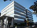
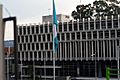
Economy and Money
Guatemala City is the capital, so it has Guatemala's central bank. This bank sets the country's money and financial rules. Many private banks also have their main offices here. These include CitiBank, Banco Industrial, and Banrural.
Guatemala City has the strongest economy in Guatemala. It is the largest market for goods and services. This means there are many chances for people and businesses to invest here. Money for these investments comes from local banks and from other countries, especially the United States. Many large department stores are in the city, like Siman, Hiper Paiz (Walmart), and Sears.
-
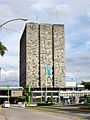
Bank of Guatemala
-
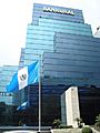
Banrural Bank
-
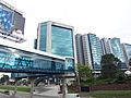
Pradera Zone.
-
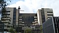
Agromercantil Bank
-
G&T Continental Bank
-
CHN Bank


Interesting Places by Zone
Guatemala City is divided into 22 zones. These zones help people find their way around. Zones are numbered from 1 to 25, but Zones 20, 22, and 23 do not exist.
| Zone | Main places | Pictures | ||
|---|---|---|---|---|
| Zone 1 |
|
|||
| Zone 2 |
|
|||
| Zone 3 |
|
|||
| Zone 4 |
|
|||
| Zone 5 |
|
|||
| Zone 6 |
|
|||
| Zone 7 |
|
|||
| Zone 8 |
|
|||
| Zone 9 |
|
|||
| Zone 10 |
|
|||
| Zone 11 |
|
|||
| Zone 12 |
|
|||
| Zone 13 |
|
|||
| Zone 14 |
|
|||
| Zone 15 |
|
|||
| Zone 16 |
|


.jpg)


Getting Around the City


- The La Aurora International Airport is south of the city center. It is Guatemala's main airport.
- Buses provide public transportation. There is also a special bus system called BRT (Bus Rapid Transit). The three main highways in Guatemala start in the city. City leaders have built new roads and underpasses to help traffic flow. They also use reversible lanes during busy times. A special police department helps manage traffic. Even with these efforts, traffic in Guatemala City can still be heavy.
- The BRT system, called Transmetro, started in 2007. It uses special lanes for large buses. This helps improve traffic by offering efficient public transport. The system has five lines and plans to expand to about 10 lines. Some busy lines might even become light or heavy metro lines.
Traditional buses now drop off passengers at transfer stations. From there, people can board the Transmetro. This change is happening as new Transmetro lines are added. There is also a prepaid bus card system called Transurbano. This system helps limit cash handling on buses. New buses have been bought for this system.
A light rail line, called Metro Riel, is also being planned.
Universities and Schools
Guatemala City has ten universities. One of them is the University of San Carlos of Guatemala. It is the oldest university in Central America, founded in 1676. It is older than almost all universities in North America.
The other nine universities in Guatemala City are private. They include Universidad Mariano Gálvez, Universidad Rafael Landivar, and Universidad Francisco Marroquín.
Sports in the City
Guatemala City has many sports fields and clubs. Football is the most popular sport. The main clubs are CSD Municipal, Aurora F.C., and Comunicaciones.
The Estadio Doroteo Guamuch Flores is the largest stadium in the country. It is located in Zone 5. Other important stadiums include Estadio Cementos Progreso and Estadio del Ejército. The Domo Polideportivo de la CDAG is a key indoor sports hall.
The city has hosted several international sports events. In 1950, it hosted the VI Central American and Caribbean Games. In 2000, it hosted the FIFA Futsal World Championship. In 2007, the International Olympic Committee met here and chose Sochi to host the 2014 Winter Olympics. In 2010, the city hosted the Pan-American Mountain Bike Championships.
Guatemala City also hosted the CONCACAF Futsal Championship in 2008. The 2024 Senior Pan American Championships will be held here in June 2024.
Panoramic Views of Guatemala City
1875

2020


International Connections
International Organizations
- Central American Parliament has its main office in Guatemala City.
Sister Cities
Guatemala City is connected with many cities around the world. These are called "twin towns" or "sister cities."
| City | Jurisdiction | Country | Year |
|---|---|---|---|
| Caracas | Capital District | 1969 | |
| San Salvador | San Salvador | 1979 | |
| Madrid | Madrid | 1983 | |
| Hollywood | Florida | 1987 | |
| Lima | Lima | 1987 | |
| Santiago de Chile | Metropolitan Santiago | 1991 | |
| Saltillo | Coahuila | 1993 | |
| La Habana | La Habana | 1997 | |
| Bogotá | Distrito Capital | 1997 | |
| San Pedro Sula | Cortés | 1999 | |
| Santa Cruz de Tenerife | Santa Cruz de Tenerife | 2002 | |
| San José | San José | 2005 | |
| Ciudad de Panamá | Panamá | 2005 | |
| Taipei | Northern Taiwan | 2007 | |
| Managua | Managua | 2008 | |
| Beijing | Beijing | 2009 | |
| Providence | Rhode Island | 2016 |
Famous People from Guatemala City
- Manuel Colom Argueta, former mayor and politician
- Ricardo Arjona, singer-songwriter
- Álvaro Arzú, former President and six-time mayor
- Miguel Ángel Asturias, writer and diplomat, Nobel Prize winner
- Raúl Aguilar Batres, engineer who designed the city's street system
- María Dolores Bedoya, Central American independence activist
- Sergio Custodio, professor and writer
- Toti Fernández, triathlete and ultramarathon runner
- Alejandro Giammattei, former President of Guatemala
- Juan José Gutiérrez, CEO of Pollo Campero
- Ted Hendricks, NFL Hall of Fame Linebacker
- Jorge de León, performance artist
- Zipacná de León (1948–2002), painter
- Carlos Mérida, painter
- Jimmy Morales, former President of Guatemala
- Gaby Moreno, singer-songwriter
- Carlos Peña, singer, winner of Latin American Idol 2007
- Luis Oliva, actor, singer, and director
- Georgina Pontaza, actress and artistic director
- Fernando Quevedo, theoretical physicist
- Rodolfo Robles, physician who discovered "Robles' Disease"
- Fabiola Rodas, singer
- Carlos Ruíz, football/soccer player
- Gabriela Asturias Ruiz, neuroscientist
- Rodrigo Saravia, Guatemala national football team player
- Shery, singer-songwriter
- Federico Urruela, award recipient
- Jaime Viñals, mountaineer who climbed seven highest peaks
- Luis von Ahn, computer scientist, founder of Duolingo and creator of CAPTCHA
- Lorena Cabnal
See also
 In Spanish: Ciudad de Guatemala para niños
