
Eureka Valley, San Francisco facts for kids
Quick facts for kids
Eureka Valley
|
|
|---|---|

Eureka Valley, looking north on Castro Street from 20th. The giant rainbow flag at Castro and Market is just visible. In the summer months, fog tends to roll in over Twin Peaks and other hills to the west in the evenings and retreat again the next morning.
|
|

Eureka Valley
Location in San Francisco
|
|
| Area | |
| • Total | 1.71 km2 (0.662 sq mi) |
| • Land | 1.71 km2 (0.662 sq mi) |
| Population
(2008)
|
|
| • Total | 12,503 |
| • Density | 7,290/km2 (18,890/sq mi) |
| ZIP Code |
94110, 94114
|
| Area code(s) | 415 |
Eureka Valley is a neighborhood in San Francisco, California. It is mostly a quiet place where people live. However, it also includes The Castro, which is one of the city's most visited areas.
This neighborhood is popular with families and a diverse community. You can often see the rainbow flag displayed here. This flag is a symbol of pride and acceptance. Eureka Valley was once a neighborhood mainly for Irish working-class families. Over time, it changed as new people moved in, especially in the 1960s. In 1977, Harvey Milk was elected to public office from this area. He was the first openly gay politician elected in California.
Contents
Where is Eureka Valley Located?
The city of San Francisco's Planning Department defines neighborhoods. They consider Eureka Valley part of a larger "Castro/Upper Market" area.
However, local groups have a more specific idea of its borders. The Castro/Eureka Valley Neighbors Association and a 2007 study define it as:
- Sanchez Street to the east
- 22nd Street to the south
- Twin Peaks to the west
- Duboce Avenue to the north
Noe Valley is located to the south of Eureka Valley. The Mission District is to its east.
Smaller Areas within Eureka Valley
Eureka Valley includes several smaller neighborhoods. These are sometimes called "micro-neighborhoods." They include The Castro and Duboce Triangle. Other neighborhood groups within Eureka Valley are:
- 19th Street (from Noe to Sanchez)
- Buena Vista (BVNA)
- Corbett Heights
- Corona Heights
- Dolores Heights (DHIC)
- Duboce Triangle (DTNA)
- Hartford Street (for Hartford, 17th to 18th)
- Mission Dolores
A Look Back: Eureka Valley's History

In 1845, a man named José de Jesús Noé was given a large piece of land. It was called Rancho San Miguel. This land stretched from Twin Peaks all the way into the areas now known as Noe and Eureka valleys.
In 1854, John M. Horner bought the ranch. He then planned out a new area called Horner's Addition. This area was bordered by Castro Street, Valencia Street, 18th Street, and 30th Street. Eureka Valley was part of the Mission Dolores area. However, it wasn't fully developed until the late 1800s and early 1900s.
Growth and Development
The opening of the Market & Castro Street Cable Car line in 1886 helped Eureka Valley grow. This new transportation made it easier for people to move there. Small wooden cottages and two-story apartments were built. The only factory in the area at that time was a mattress factory.
Most of the early residents were working-class people. They included tradesmen, small business owners, and civil servants. Many were immigrants from Ireland, Germany, Britain, and Scandinavia.
Surviving the 1906 Earthquake
Eureka Valley was lucky during the 1906 San Francisco earthquake. The fires that followed the earthquake stopped at Dolores Street. This meant the neighborhood was saved from destruction.
After the earthquake, many people who lost their homes moved to Eureka Valley. They bought land and built new cottages and apartments. The area continued to grow even more after the Twin Peaks Tunnel was finished in 1918. The Municipal Railway's J Church streetcar line also opened in 1917, making travel even easier.
Community Efforts and Local Services
The Eureka Valley Improvement Association was started in 1905. This group worked hard to improve the neighborhood. They asked the city for better streetcar service, more streetlights, and new public schools. This association also played a big role in stopping the fires after the 1906 earthquake.
The Eureka Valley branch of the San Francisco Public Library opened in 1902. It was located at Noe and Seventeenth streets. The first building was damaged in a 1957 earthquake. A new library was built in 1962 and updated in 2009.
The main shopping area of Eureka Valley is around 18th Street and Castro Street. In the 1970s, this area became known as "The Castro." It developed into a welcoming place for a diverse community.
Images for kids
-
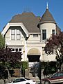
The John McMullen House on Guerrero Street is listed on the National Register of Historic Places
.JPG)
