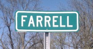
Farrell, Mississippi facts for kids
Quick facts for kids
Farrell, Mississippi
|
|
|---|---|
 |
|
| Country | United States |
| State | Mississippi |
| County | Coahoma |
| Area | |
| • Total | 1.30 sq mi (3.36 km2) |
| • Land | 1.30 sq mi (3.36 km2) |
| • Water | 0.00 sq mi (0.00 km2) |
| Elevation | 164 ft (50 m) |
| Population
(2020)
|
|
| • Total | 200 |
| • Density | 154.08/sq mi (59.50/km2) |
| Time zone | UTC-6 (Central (CST)) |
| • Summer (DST) | UTC-5 (CDT) |
| ZIP code |
38630
|
| Area code(s) | 662 |
Farrell is a small community in Coahoma County, Mississippi, United States. It's known as an unincorporated community, which means it doesn't have its own local government like a city or town. It's also a census-designated place, which is an area the government defines for counting people.
In 2020, about 200 people lived in Farrell. You can find Farrell about 4 miles (6.4 km) south of Stovall and 4 miles (6.4 km) north of Sherard. It's located right on Mississippi Highway 1. The community is also about 9 miles (14.5 km) northwest of Clarksdale, which is the main city in Coahoma County. Farrell even has its own post office with a zip code of 38630.
Climate in Farrell
The weather in Farrell is usually warm and humid. This type of weather is called a humid subtropical climate. It means that summers are hot and muggy, while winters are generally mild or cool.
Who Lives in Farrell?
Every ten years, the United States government counts everyone living in the country. This count is called a census. It helps us understand how many people live in different places and what groups they belong to.
Farrell's Population in 2020
According to the 2020 census, 200 people lived in Farrell. Most people in Farrell are Black or African American. In 2020, about 88% of the population was Black or African American. About 8.5% of the people were White. A small number of people identified as other races or as being of mixed race. There were also a few people who identified as Hispanic or Latino.
See also
 In Spanish: Farrell (Misisipi) para niños
 | Bessie Coleman |
 | Spann Watson |
 | Jill E. Brown |
 | Sherman W. White |


