Finger Lake (Alaska) facts for kids
Quick facts for kids Finger Lake |
|
|---|---|
| Baqay Tuch'elisht Bena | |
 |
|
| Location | Wasilla, Alaska |
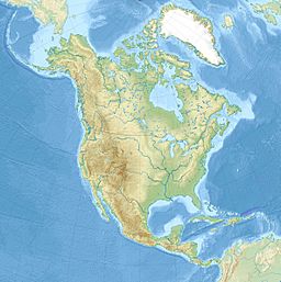
| Coordinates | 61°36′18″N 149°16′52″W / 61.605°N 149.281°W |
| Native name | Bakiatutsilictmuna Error {{native name checker}}: parameter value is malformed (help) |
| Primary outflows | one small, unnamed creek |
| Surface area | 146 acres (59 ha) |
| Max. depth | 13.4 meters (44 ft) |
| Surface elevation | 103 meters (338 ft) |
| Frozen | winter months |
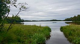
Finger Lake is a beautiful lake located in Wasilla, Alaska. It's a very popular place for outdoor fun, especially fishing!
Even though it's called "Finger Lake," it's not actually a type of lake known as a finger lake. It got its name from Captain Edward Glenn. He led an army trip to Alaska in 1898. He thought a point of land in the lake looked like a finger when he saw it on a map.
Fun Activities at Finger Lake
Finger Lake is a favorite spot for people who love to fish. The lake is home to several types of fish. You can find Rainbow Trout, Arctic Char, and Arctic Grayling here.
During the cold winter months, the lake freezes over. This makes it a great place for ice fishing. Many people enjoy dropping their lines through holes in the ice.
The lake is also part of a fun canoe trail. This trail is seven miles long. It starts at the south end of Finger Lake. The trail ends at Wasilla Lake. There is only one short carry-over spot, called a portage, at the north end of Finger Lake.
Finger Lake State Recreation Area
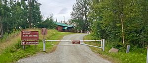
The Finger Lake State Recreation Area is a large park. It covers about 69 acres. This park is managed by Alaska State Parks.
The recreation area offers many things to do. It has a campground where you can stay overnight. There is also a boat launch, making it easy to put your boat in the water. Plus, there are picnic areas where families can enjoy meals outdoors.
The park is also important for managing other parks nearby. It contains the main office for parks in the Matanuska-Susitna Valley area.
 | Emma Amos |
 | Edward Mitchell Bannister |
 | Larry D. Alexander |
 | Ernie Barnes |


