Wasilla Lake facts for kids
Quick facts for kids Wasilla Lake |
|
|---|---|
| Lach Bena | |

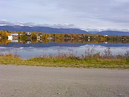
The lake seen from the George Parks Highway
|
|
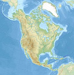
| Location | Wasilla, Alaska |
| Coordinates | 61°35′14″N 149°23′33″W / 61.58722°N 149.39250°W |
| Primary inflows | Wasilla Creek |
| Primary outflows | Cottonwood Creek |
| Basin countries | United States |
| Average depth | 17 feet (5.2 m) |
| Max. depth | 48 feet (15 m) |
| Water volume | 279,306,668 cubic feet (7,909,084.1 m3) |
| Shore length1 | 4.4 miles (7.1 km) |
| 1 Shore length is not a well-defined measure. | |
Wasilla Lake is a beautiful lake located in Wasilla, Alaska. It was named by the workers who built the Alaska Railroad. They named it after a nearby stream called Wasilla Creek. The lake is a popular spot for outdoor activities and is home to a city park.
Exploring Wasilla Lake
Wasilla Lake is a freshwater lake in Alaska. It is known for its clear waters and natural beauty. The lake's shore stretches for about 4.4 miles. Most of the land around the lake is privately owned. However, there are public areas for everyone to enjoy.
Newcomb Park and the Canoe Trail
One of the main public spots at Wasilla Lake is Newcomb Park. This park is a great place to visit. It offers a chance to relax by the water.
The lake is also the start of the Seven-Mile Canoe Trail. This trail is a fun adventure for canoe and kayak lovers. It connects Wasilla Lake to another lake called Finger Lake. Imagine paddling through seven miles of beautiful Alaskan scenery!
Fishing Adventures
If you love fishing, Wasilla Lake is a fantastic spot! The lake has a healthy population of rainbow trout. This means there are usually plenty of fish to catch.
You can enjoy fishing from the shore. You can also go out on a boat. When winter comes, the lake freezes over. This makes it a perfect place for ice fishing. Many people enjoy catching rainbow trout here all year round.
 | DeHart Hubbard |
 | Wilma Rudolph |
 | Jesse Owens |
 | Jackie Joyner-Kersee |
 | Major Taylor |


