Finham Brook facts for kids
Quick facts for kids Finham Brook |
|
|---|---|

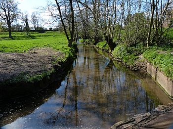
Finham Brook in Kenilworth
|
|
|
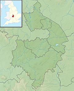
Location of the mouth within Warwickshire
|
|
| Country | England |
| Counties | Warwickshire |
| Physical characteristics | |
| River mouth | River Sowe 52°21′40″N 1°30′27″W / 52.3612°N 1.5074°W |
The Finham Brook is a small river in England. It flows through Kenilworth and Warwickshire. This brook eventually joins a bigger river called the River Sowe near Finham.
The Finham Brook has two main smaller streams that feed into it. One is the Canley Brook, which gathers water from areas like Tile Hill and Canley in Coventry. The other is the Inchford Brook, which starts near Beausale. It then flows in a curve through the area of Beausale, Haseley, Honiley and Wroxall. Together, the Finham and Inchford brooks are about 24 kilometers (15 miles) long. They collect water from a total area of 71 square kilometers (27 square miles).
Contents
Where the Finham Brook Flows
The Finham Brook starts its journey near Burton Green. This area is southwest of Coventry. At first, it flows towards the southeast. It then reaches the edge of Kenilworth town.
Meeting the Inchford Brook
The Finham Brook meets the Inchford Brook near Kenilworth Castle. Here, a special path called the Tiltyard causeway crosses over the brook. This causeway was built a long time ago. After this point, the brook turns east and flows right through Kenilworth.
Crossing Kenilworth
Next to the castle, Castle Road crosses the brook. This crossing is known as the Kenilworth Ford. When there's a lot of rain, the water level rises. This makes it impossible for cars to cross. However, people can still walk across using a nearby footbridge. The brook then flows through a park called Abbey Fields. It goes under the A452 road.
Journey to the River Sowe
The Finham Brook continues through the Mill End part of Kenilworth. It flows alongside the Common. Near Crackley, it meets the Canley Brook. The brook then heads northeast. It passes under the A46 dual carriageway. Finally, it flows through the Finham sewage works. It joins the River Sowe upstream of Stoneleigh.
History of the Brooks
The Inchford and Finham brooks played an important role in the past. In the 13th century, King John had a dam built. This dam was called the Tiltyard causeway. It created a lake and helped protect Kenilworth Castle.
The Canley Brook, which is a stream that flows into the Finham Brook, also has history. In medieval times, there was a watermill on the Canley Brook. This mill was located near Crackley.
Flooding and Warnings
Some parts of Kenilworth can get flooded by the Finham Brook. To help keep people safe, there is a special flood warning service. This service covers the Finham Brook, along with the Sowe, Sherbourne, and Canley brooks.
The Kenilworth ford, where Castle Road crosses the brook, also has its own warning system. Signs are used to tell drivers when the road is flooded. This helps them know when to use a different route.
Ecology and Water Quality
The health of the Finham Brook has been checked. This check is part of something called the Water Framework Directive. The brook is divided into two parts: upper and lower. The Canley Brook is also checked separately.
All three parts of the brook are in the "moderate" category. This is the middle level on a scale that goes from "high" to "bad." It means the water quality is okay, but there's always room for improvement.
 | Precious Adams |
 | Lauren Anderson |
 | Janet Collins |


