Fort Totten (Washington, D.C.) facts for kids
Quick facts for kids
Fort Totten
|
|
|---|---|
|
Neighborhood of Washington, D.C.
|
|

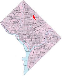
Fort Totten within the District of Columbia
|
|
| Country | United States |
| District | Washington, D.C. |
| Ward | Ward 5 |
| Time zone | UTC−05:00 (EST) |
| • Summer (DST) | UTC−04:00 (EDT) |
| ZIP Code |
20011
|
| Area code(s) | 202 |
| Geocode | 87C4WXXV+9V |
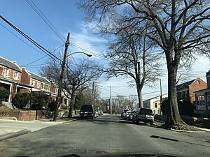
Fort Totten is a cool neighborhood in Washington, D.C.. It's located in the northeast part of the city, in an area called Ward 5.
This neighborhood is surrounded by important roads and landmarks. To the north, you'll find Riggs Road. To the south, there's Bates Road, Allison Street, and the start of Fort Totten Park. The Washington Metro Red Line train tracks are to the east. To the west, you'll find North Capitol Street.
The Washington Metro Green Line also passes through Fort Totten. It goes through a tunnel under Fort Totten Park. This tunnel connects the Fort Totten and Georgia Avenue-Petworth Metro Stations. Fort Totten is next to other neighborhoods like Riggs Park, Queens Chapel, Michigan Park, Brightwood Park, and Petworth.
Fort Totten is close to many interesting places. These include Catholic University of America, Providence Hospital, and Rock Creek Cemetery. It's also near President Lincoln's Cottage. The neighborhood gets its name from a Civil War-era fort. This fort was named after Joseph Gilbert Totten. He was a top engineer in the United States Army before the Civil War.
People living in Fort Totten have great access to outdoor spaces. They can visit Fort Totten Park. There's also the Washington Metropolitan Branch Trail. This trail is perfect for walking or biking. It stretches from the Silver Spring Metro Station all the way to Washington Union Station.
Getting around is easy from Fort Totten. The Fort Totten Metro Station is right there. The Red Line has served this station since 1978. The Green Line joined in 1993. And the Yellow Line started serving it in 2006. Many Metrobus routes also serve the area.
The Civil War Fort: A Look Back in Time
The Fort Totten neighborhood is named after an old Civil War fort. This fort sits on top of a hill in the area. It was built in 1861 and finished in 1863. Its main job was to protect Washington, D.C., during the Civil War. The fort was named after Joseph Gilbert Totten. He was a general who fought in the War of 1812.
Fort Totten Park Today
You can still see parts of the old fort today. The earthworks, which are like big dirt walls, are very clear. You can also see the ditch that surrounded the fort. Inside, there are walls from two old storage rooms called magazines.
A smaller part of the fort, called Totten Battery, is also visible. It's about 1000 feet north of the main fort. You can also see the connecting trenches where soldiers would have hidden. The park is a nice place to visit. It has picnic benches for families and friends. There's also a special plaque. It marks the main entrance to the fort's remains.
 |
Manor Park | Riggs Park |  |
|
| Petworth Rock Creek Cemetery |
Queens Chapel | |||
| United States Soldiers' and Airmen's Home National Cemetery | Pleasant Hill | Michigan Park |


