Fox Glacier (town) facts for kids
Quick facts for kids
Fox Glacier
Weheka (Māori)
|
|
|---|---|
|
Village
|
|
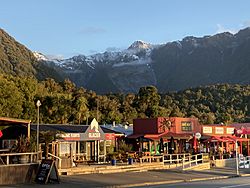
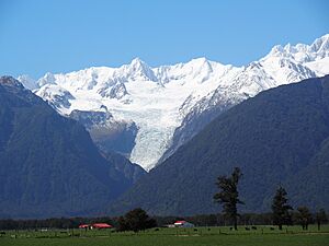
Fox Glacier and Craig Peak
|
|
| Country | New Zealand |
| Region | West Coast |
| District | Westland District |
| Ward | Southern |
| Electorates |
|
| Area | |
| • Total | 2.81 km2 (1.08 sq mi) |
| Population
(June 2023)
|
|
| • Total | 300 |
| • Density | 107/km2 (280/sq mi) |
| Time zone | UTC+12 (NZST) |
| • Summer (DST) | UTC+13 (NZDT) |
| Postcode |
7886
|
| Area code(s) | 03 |
| Local iwi | Ngāi Tahu |
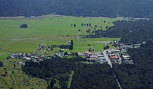
Fox Glacier (Māori: Weheka) is a small village on the West Coast of the South Island of New Zealand. It's famous for being very close to the amazing Fox Glacier / Te Moeka o Tuawe, which is a huge river of ice!
Contents
What's in a Name?
The village was called Weheka until the 1940s. Then, its post office changed its name to Fox Glacier, just like the big glacier nearby. The glacier got its name in 1872 after William Fox, who was the leader of New Zealand at the time, visited it.
A Look Back in Time
The story of Fox Glacier village began about 20 kilometres (12 mi) away, at a place called Gillespies Beach. In the 1860s, many people rushed there hoping to find gold. For a short time, Gillespies Beach was one of the biggest towns on the West Coast!
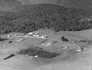
But as the gold ran out, most people left. Some families, like the Sullivans, moved inland. Patrick Sullivan and his friend Fred Williams decided to try farming in the Weheka Valley. Julia Sullivan married Fred Williams in 1893 and built a farmhouse near where the village is now. By the early 1900s, they had cleared a lot of forest to create farmland.
Getting to the settlement used to be hard. Boats would arrive at Gillespies Beach, and goods had to be carried by horses and carts all the way to Weheka. The road to the north was very rough. One surveyor even said it was better to walk through the bush! But by 1903, the road got much better for horses.
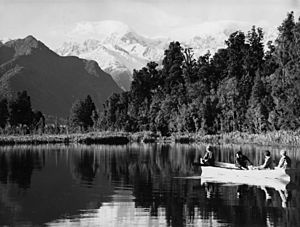
In the 1920s, the Westland area started to become popular for tourists. The Williams and Sullivan families had already been welcoming visitors to their homes. In 1926, Mick and Jack Sullivan decided to build a proper place for tourists. They built the Fox Glacier Hostel, which opened in 1928. It was a big place with 40 bedrooms and its own power supply from the Sullivan farm. The hotel quickly became the main hub for visitors, organizing trips to places like Lake Matheson for its famous reflections.
Where is Fox Glacier?
Location and Surroundings
Fox Glacier village is about 46 kilometres (29 mi) north-east of Bruce Bay and 23 kilometres (14 mi) south-west of Franz Josef / Waiau. The main road, State Highway 6, goes right through the village. The village is only about 6 kilometres (3.7 mi) from the famous Fox Glacier itself, and also close to Lake Matheson.
Fox Glacier is mainly a place that helps tourists, but it also supports the local farms.
Weather in Fox Glacier
| Climate data for Fox Glacier (1981–2010) | |||||||||||||
|---|---|---|---|---|---|---|---|---|---|---|---|---|---|
| Month | Jan | Feb | Mar | Apr | May | Jun | Jul | Aug | Sep | Oct | Nov | Dec | Year |
| Mean daily maximum °C (°F) | 19.0 (66.2) |
19.9 (67.8) |
18.5 (65.3) |
16.1 (61.0) |
13.9 (57.0) |
11.9 (53.4) |
11.5 (52.7) |
12.3 (54.1) |
13.6 (56.5) |
14.5 (58.1) |
16.3 (61.3) |
17.9 (64.2) |
15.5 (59.8) |
| Daily mean °C (°F) | 14.7 (58.5) |
15.2 (59.4) |
13.9 (57.0) |
11.6 (52.9) |
9.3 (48.7) |
7.3 (45.1) |
6.7 (44.1) |
7.6 (45.7) |
9.1 (48.4) |
10.3 (50.5) |
11.9 (53.4) |
13.7 (56.7) |
10.9 (51.7) |
| Mean daily minimum °C (°F) | 10.4 (50.7) |
10.6 (51.1) |
9.3 (48.7) |
7.1 (44.8) |
4.8 (40.6) |
2.8 (37.0) |
1.9 (35.4) |
2.9 (37.2) |
4.6 (40.3) |
6.1 (43.0) |
7.6 (45.7) |
9.6 (49.3) |
6.5 (43.7) |
| Average rainfall mm (inches) | 585.9 (23.07) |
322.1 (12.68) |
482.6 (19.00) |
312.0 (12.28) |
336.4 (13.24) |
393.5 (15.49) |
370.3 (14.58) |
377.9 (14.88) |
343.8 (13.54) |
565.3 (22.26) |
368.5 (14.51) |
549.9 (21.65) |
5,008.2 (197.18) |
| Source: CliFlo | |||||||||||||
Things to See and Do
The Fox Glacier itself is the biggest reason people visit the village. You can get great views of the glacier from several walking and cycling paths.
- Fox Glacier South Side Walkway/Cycleway: This 6.4 kilometres (4.0 mi) path goes along the south side of the Fox River. It takes you through old forests and over rocky hills left behind by the glacier, called moraines.
- Te Kopikopiko o te Waka: This special viewing spot is about 9 kilometres (5.6 mi) west of the village. It offers amazing views of the Southern Alps / Kā Tiritiri o te Moana and Fox Glacier. It was created in 2022 and shares stories from the Ngāi Tahu Māori people.
- Minnehaha Walk: This is a short 1.2 kilometres (0.75 mi) loop walk through a beautiful forest near the village. If you go at night, you might even see glowworms!
- Te Weheka Walkway/Cycleway: This 5 kilometres (3.1 mi) path goes from the village to the north side of the Fox River. You can see a huge landslide called the Alpine Gardens landslide, which is still moving!
- Mt Fox Route: For experienced hikers, this challenging climb takes you up Mt Fox to 1,021 metres (3,350 ft). It offers incredible views but needs good gear and experience.
- Gillespies Beach: About 20 kilometres (12 mi) west of Fox Glacier, this black sand beach was once a gold mining area. You can camp there and enjoy coastal walks.
- Lake Matheson: This small lake is about 5 kilometres (3.1 mi) from the village. It's famous for its perfect reflections of Aoraki / Mount Cook and Mount Tasman on clear days. There's an easy 4.4 kilometres (2.7 mi) walking track around the lake.
- Lake Gault Track: This 8 kilometres (5.0 mi) return path climbs through old forests to a lookout over a small lake. You can see the Southern Alps, Aoraki / Mount Cook, and Mount Tasman from here. This track was reopened in 2019 after being closed for 20 years!
Who Lives Here?
Fox Glacier is a small rural village that covers about 2.81 square kilometres (1.08 sq mi). As of June 2023, about 300 people live here.
| Historical population | ||
|---|---|---|
| Year | Pop. | ±% p.a. |
| 2006 | 285 | — |
| 2013 | 234 | −2.78% |
| 2018 | 249 | +1.25% |
In 2018, there were 249 people living in Fox Glacier. The village has a mix of different cultures. Many people work full-time, often in tourism.
Getting Around and Services
State Highway 6, a major road, goes through the town. There's also a small airport called Fox Glacier Aerodrome.
The village has electricity, which comes from a main power grid far away. There's also a local hydroelectric power station that can provide power if the main supply is cut off. Fox Glacier also has its own water and wastewater systems.
Places of Worship
Our Lady of the Snows
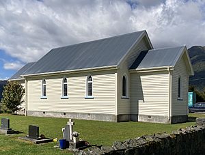
This is a Catholic church built from wood in 1934. It has beautiful stained-glass windows. People in the area donated these windows and statues to remember their family members. Church services are held here twice a month.
Douglas Memorial Church
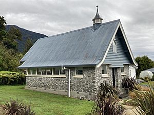
This was a small Presbyterian church built in 1952 from local stone. It was named after a minister named William Douglas. Because fewer people were attending, the church was sold in 2012. It has now been turned into a holiday home called The Church at Fox.
Learning in Fox Glacier
The first school in the area was Gillespies Beach School, which opened in 1877. It closed in 1900 when the population dropped. For the next 30 years, children were taught in homes.
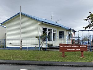
Then, in 1929, Weheka School opened. It later became Fox Glacier School, and is now called Fox Glacier Weheka School.
It's the only school in Fox Glacier, teaching about 10 students from ages 5 to 12. The closest high school is about 85 kilometres (53 mi) away in Hari Hari.
 | Selma Burke |
 | Pauline Powell Burns |
 | Frederick J. Brown |
 | Robert Blackburn |


