Fox Islands (Michigan) facts for kids
| Geography | |
|---|---|
| Location | Lake Michigan |
| Coordinates | 45°26′32″N 85°48′36″W / 45.44222°N 85.81000°W |
| Total islands | 2 |
| Area | 6.65 sq mi (17.2 km2) |
| Highest elevation | 577 ft (175.9 m) |
| Administration | |
|
United States
|
|
| State | Michigan |
| County | Leelanau County |
| Township | Leelanau Township |
| Demographics | |
| Population | Uninhabited |
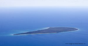
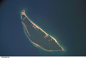
The Fox Islands are two cool islands in Lake Michigan. They are called North Fox and South Fox. These islands are not lived on by people. You can find them about 17 miles (27 km) northwest of Cathead Point in Michigan. They are also about 10 miles (16 km) southwest of Beaver Island. These two islands are part of a group of islands called an archipelago.
A lighthouse called South Fox Island Light was built there in 1867. It helped ships navigate until 1959. Both islands are part of Leelanau County, Michigan. They are managed by Leelanau Township.
Contents
Discovering North Fox Island
North Fox Island is the smaller of the two islands. It covers about 3.32 square kilometers (1.28 sq mi). It is roughly 2 miles (3.2 km) wide and 1 mile (1.6 km) long. In 1994, a real estate businessman named David V. Johnson bought this island. He paid $1.3 million for it.
By the end of 2000, the entire island was sold back to the state of Michigan. The state paid $2.2 million for it. Today, North Fox Island is part of the Beaver Islands State Wildlife Research Area. This area helps protect wildlife.
North Fox Island has a public airstrip. It is made of turf and is 3,000 feet (910 m) long. This means small planes can land there. The airport code for this runway is 6Y3.
Exploring South Fox Island
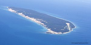
South Fox Island is much larger than North Fox Island. It is about 13.89 square kilometers (5.36 sq mi) in size. The island is about 5 miles (8 km) long and 1.5 miles (2.4 km) wide. As of 2001, David V. Johnson owned about two-thirds of South Fox Island. The state of Michigan owned the other third. This state-owned land included the two lighthouses on the island's southern tip.
It is hard to get to South Fox Island. There is no public boat service. The island also has no docks, fuel, or safe harbor for boats. However, there is a private airport on the island. It has a 5,500-foot (1,700 m) paved runway. This runway is long enough for jet planes.
South Fox Island Lighthouses
Two lighthouses stand on the southern end of South Fox Island. The first lighthouse was built in 1867. It is a brick house with a tower attached. The second lighthouse is a tall, skeletal tower. It was moved to the island in 1934 from Sapelo Island.
A group called the Fox Island Lighthouse Association (FILA) was started in 2004. This group works to help save and protect the old lighthouse buildings.
Island Features and Wildlife
Mr. Johnson built a paved runway and a home on South Fox Island. The runway is about 1,600 meters (5,200 ft) long. He owns 2,204 acres (892 ha) on this isolated island. South Fox Island is known for its amazing natural beauty. It has tall sand dunes, old cedar trees, and untouched beaches.
The island also has a cemetery. Members of the Grand Traverse Band of Native Americans are buried there.
Deer were brought to the island in 1915. People can hunt deer on the state-owned land. However, they must have a special permit to do so.
 | Isaac Myers |
 | D. Hamilton Jackson |
 | A. Philip Randolph |


