
Francisco, Indiana facts for kids
Quick facts for kids
Francisco, Indiana
|
|
|---|---|
 |
|
| Nickname(s):
"Frisco"
|
|

Location of Francisco in Gibson County, Indiana.
|
|
| Country | United States |
| State | Indiana |
| County | Gibson |
| Township | Center |
| Area | |
| • Total | 0.62 sq mi (1.60 km2) |
| • Land | 0.61 sq mi (1.58 km2) |
| • Water | 0.01 sq mi (0.02 km2) |
| Elevation | 449 ft (137 m) |
| Population
(2020)
|
|
| • Total | 545 |
| • Density | 893.44/sq mi (344.80/km2) |
| Time zone | UTC-6 (CST) |
| • Summer (DST) | UTC-5 (CDT) |
| ZIP code |
47649
|
| Area code(s) | 812, 930 |
| FIPS code | 18-25306 |
| GNIS feature ID | 2396948 |
Francisco is a small town in Gibson County, Indiana, United States. It is the fifth largest town in the county. In 2020, about 545 people lived there.
The town was founded in 1851. Local stories say it was named after its first settler. This person was a Spanish worker who built a small home while working on the Wabash and Erie Canal. Francisco is part of the larger Evansville Metropolitan Area.

Contents
About Francisco
Francisco is located in Center Township. Its exact location is 38°20′0″N 87°26′50″W / 38.33333°N 87.44722°W.
The town covers about 0.62 square miles (1.6 square kilometers) of land. It is situated along State Highway 64. This highway connects Francisco to nearby towns like Princeton and Oakland City.
In 2010, the town had 469 residents. Most people living in Francisco are White (97.0%). A small number of residents are African American, Native American, or Asian. About 0.9% of the population identified as Hispanic or Latino.
Population Changes Over Time
The number of people living in Francisco has changed throughout history. Here's a look at the population from 1910 to 2020:
| Historical population | |||
|---|---|---|---|
| Census | Pop. | %± | |
| 1910 | 407 | — | |
| 1920 | 614 | 50.9% | |
| 1930 | 728 | 18.6% | |
| 1940 | 611 | −16.1% | |
| 1950 | 606 | −0.8% | |
| 1960 | 565 | −6.8% | |
| 1970 | 621 | 9.9% | |
| 1980 | 612 | −1.4% | |
| 1990 | 560 | −8.5% | |
| 2000 | 543 | −3.0% | |
| 2010 | 469 | −13.6% | |
| 2020 | 545 | 16.2% | |
| U.S. Decennial Census | |||
History of Francisco


Francisco was officially planned and laid out in 1851 by John Perkins. It was built on the east side of the Wabash and Erie Canal. The town became an incorporated (officially recognized) town in 1907. The Francisco State Bank opened a year later.
The town was busiest in the mid-1850s. This was when the Wabash and Erie Canal was actively used to move goods and farm products. Mills, grain warehouses, and packing businesses were very successful during this time. You can still see parts of the old canal just south of Highway 64 and west of town.
Town Government
The Francisco Town Hall is located at 203 West Main Street (also known as State Road 64). The town's Fire Department is also located there.
Town meetings are held on the second Tuesday of every month. Meetings about wastewater start at 5:30 PM, followed by discussions about water and other town business.
Transportation
Francisco is connected by important roads and rail lines:
 State Road 64
 Interstate 69 (This major highway is about 2 miles east of town.)
- Norfolk Southern Railway (A railway line also passes through the area.)
Schools in Francisco
Francisco Elementary School is part of the East Gibson School Corporation. The school is located on State Road 64 (Main Street) in Francisco. It is home to the "Mighty Owls" and teaches students from kindergarten through sixth grade.
At least three school buildings have stood on the grounds where the current school is. Two of the previous schools were destroyed by fire. The last Francisco High School burned down in the 1970s after being struck by lightning. During the construction of a new school, the Lions Club building (shown in the gallery below) was used for grades 5-8. Local churches, including the Methodist, Baptist, and Nazarene churches, also provided classroom space.
A very old, small, one-room schoolhouse once stood near the intersection of Green and School Streets. This is why the current school is not on the same side of town as School Street today.
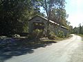
The Wabash & Erie Canal
Francisco was built on the east banks of the Wabash and Erie Canal. This man-made canal stretched from Lake Erie in Ohio all the way to the Ohio River at Evansville. Many Irish workers came to Francisco to help build the canal.
The canal was most active in the mid-1850s. It was closed to traffic around 1870. During its construction, many workers faced difficult conditions. The canal played a big role in the early growth of Francisco.
Images for kids
-
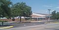
Francisco Elementary School in 2010
-
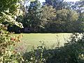
Wabash Erie Canal near Francisco
-
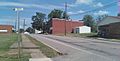
A view looking up Main Street (SR64)
-
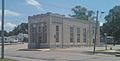
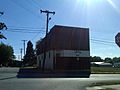
The old Francisco State Bank building
-
The IOOF building at Main & 4th Street
-
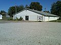
The Lions Club Building on South 1st Street
-
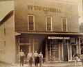
The WS McConnell Building
-
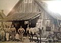
A Blacksmith Shop that still stands on South 3rd Street
-
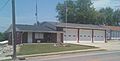
The Fire Department building before its 2011 addition
-
A covered bridge north of Francisco at Patoka River


See also
 In Spanish: Francisco (Indiana) para niños
