Francois Peron National Park facts for kids
Quick facts for kids Francois Peron National ParkWestern Australia |
|
|---|---|
|
IUCN Category II (National Park)
|
|
 |
|
| Nearest town or city | Geraldton, Western Australia |
| Established | 1993 |
| Area | 525.87 km2 (203.0 sq mi) |
| Managing authorities | Department of Parks and Wildlife |
| Website | Francois Peron National Park |
| See also | List of protected areas of Western Australia |
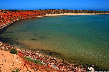
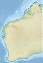
The Francois Peron National Park is a special place in Western Australia. It's about 726 kilometers (451 miles) north of Perth, the capital city. This park is located on the Peron Peninsula and is part of the amazing Shark Bay World Heritage area.
The closest town to the park is Denham, which is right on its southern edge. Another town, Carnarvon, is about 80 kilometers (50 miles) north. The park is managed by the Department of Parks and Wildlife.
Contents
Park's History and Names
First Peoples of the Land
Aboriginal Australians were the very first people to live in this area. They have been here for more than 26,000 years! The local people who speak the Malgana language call this special place Wulyibidi.
How the Park Got Its Name
The park is named after a French explorer and scientist named François Péron. He was a zoologist, which means he studied animals. François Péron explored Western Australia on scientific trips in 1801 and 1803. The park is also located where a large farm, called Peron Station, used to be.
Places Named by French Explorers
Some places in the park still have names given by French explorers:
- Guichenault (on the east coast of the Peron Peninsula)
- Cape Lesueur (on the west coast of the Peron Peninsula)
- Lake Montbazin
Pearling and Farming History
In the 1880s, people set up a pearling camp on the peninsula at Herald Bight. You can still find old shells from this time along the beach.
Later, starting in the early 1900s, the area was used as a sheep station, which is a big farm for sheep. The government of Western Australia bought this farm in 1990.
The area officially became a National Park on January 8, 1993. This happened after the government bought the Peron Station farm.
Where is the Park Located?
The Francois Peron National Park is surrounded by water and other protected areas. To its west, north, and east, it is next to the Shark Bay Marine Park. This marine park protects the ocean and marine life. To the south, the park is bordered by the road that goes from Denham to Monkey Mia.
Things to Do and See
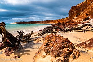
The park has many great spots for visitors. You can enjoy picnics, launch your boat, or even camp overnight. These areas are mostly found along the west coast of the peninsula.
Popular Visitor Spots
Here are some of the popular places you can visit:
- Big Lagoon
- Cape Lesueur
- Cattle Well
- South Gregories
- Gregories
- Bottle Bay
 | Frances Mary Albrier |
 | Whitney Young |
 | Muhammad Ali |


