
Denham, Western Australia facts for kids
Quick facts for kids DenhamWestern Australia |
|||||||||
|---|---|---|---|---|---|---|---|---|---|

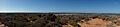
A view of Denham from the air
|
|||||||||

Denham
Location in Western Australia
|
|||||||||
| Postcode(s) | 6537 | ||||||||
| Elevation | 9 m (30 ft) | ||||||||
| Area | [convert: needs a number] | ||||||||
| Location | |||||||||
| LGA(s) | Shire of Shark Bay | ||||||||
| State electorate(s) | North West | ||||||||
| Federal Division(s) | Durack | ||||||||
|
|||||||||
Denham is a small town in Western Australia. It's the main town for the Shire of Shark Bay. In 2016, about 754 people lived there. Denham is on the western coast of the Peron Peninsula, about 831 kilometres (516 mi) north of Perth. It's the most western town in Australia that you can visit!
The town is named after Captain Henry Mangles Denham, who explored Shark Bay in 1858. Today, Denham is a popular spot for tourists. Many visitors come to see the dolphins at Monkey Mia, which is just 23 kilometres (14 mi) away. Denham also has a nice beach and a jetty, which are great for fishing and boating. This area was one of the first parts of Australia discovered by European sailors.
Contents
History of Denham

The Denham area has a long and interesting history.
Early European Explorers
On October 25, 1616, a Dutch explorer named Dirk Hartog and his crew accidentally found some islands. They landed on an island now called Dirk Hartog Island, near Shark Bay. Hartog spent three days looking around the coast and nearby islands. He named the area Eendrachtsland after his ship, but this name isn't used anymore. Since he didn't find much of interest, Hartog kept sailing north.
Later, in 1696, another Dutch explorer named Willem de Vlamingh also landed on the island. Other famous explorers who visited the area include William Dampier and the Frenchmen Freycinet, Hamelin, and Baudin in the early 1800s.
Pearling and Early Settlement
Europeans didn't settle on this coast until the mid-1800s. The first pearls found in Western Australia were discovered in Shark Bay in 1854. Lieutenant Helpman found many pearl-shell oysters there. Before it was called Denham, the town was known as Freshwater Camp. This was because it was a busy camp for pearling.
Life in Denham
Denham is a small community with many services.
Population and Language
In the 2016 Census, there were 754 people living in Denham. Most people, about 72.1%, were born in Australia. Also, 84.7% of people living there spoke only English at home.
Local Facilities and Services
Even though it's a small town, Denham has many useful facilities. These include:
- A crisis center
- Two churches
- A unit of the Red Cross
- A Returned Services League (RSL)
- Shops like grocery and hardware stores
- A hairdressing salon
- Hotels and caravan parks
- Different types of holiday accommodation
- A butcher shop
- Tourist and souvenir shops
- A restaurant called Old Pearler Restaurant
For health, there isn't a full-time doctor. However, a nurse is always available at the local Silver Chain Nursing post. A doctor also flies in for two days once a week. Emergency services like the Fire Brigade, Ambulance, State Emergency Service, and Marine Rescue are all run by volunteers.
Denham gets its electricity from a special power plant that uses both wind and diesel. There are also plans to try using hydrogen to power the town in the future!
Community Activities
Denham has many social groups and sports clubs. These include:
- A bowls club
- A golf club
- A speedway
- An arts society
- A film club
- A pistol club
- A bridge club
- A crafts group
- A youth association
- Facilities for sports like netball, cricket, and football
Tourism and Attractions
Tourism is very important to Denham. The main tourist season is from April to September.
World Heritage Drive
Many tourists visit the Shark Bay area. The road that connects the main North West Coastal Highway to Denham is called World Heritage Drive. It's about 150-kilometre (93 mi) long and takes you through beautiful scenery.
Tour Operators
Several tour companies offer trips from Denham and Monkey Mia. They have tours on both land and water.
Ocean Park Aquarium
About 10 kilometres (6.2 mi) south of Denham, you'll find Ocean Park Aquarium. This aquarium has Western Australia's largest shark lagoon. It's one of the few places in Australia where you can see tiger sharks. The daily shark feedings are a very popular event for visitors!
Getting to Denham
Denham has an airport called Monkey Mia Airport. It's also known as Denham Airport or Shark Bay Airport. Regional Express Airlines offers regular flights here, making it easy for tourists to fly into Denham and Monkey Mia.
Sister Town
Denham has a special connection with another town. It is twinned with Denham, Buckinghamshire in the United Kingdom. This means the two towns share a friendly relationship.
Climate in Denham
Denham has a semi-arid climate. This means it's generally dry. Summers are warm, but not as hot as places further inland because the coast helps to cool it down. Most of Denham's rain falls in winter. This rain comes from cold fronts moving in from the Indian Ocean. However, Denham gets less rain than places further south like Geraldton and Perth. From September to March, it's usually very dry. Sometimes there might be thunderstorms or effects from tropical cyclones.
| Climate data for Denham | |||||||||||||
|---|---|---|---|---|---|---|---|---|---|---|---|---|---|
| Month | Jan | Feb | Mar | Apr | May | Jun | Jul | Aug | Sep | Oct | Nov | Dec | Year |
| Record high °C (°F) | 46.5 (115.7) |
47.0 (116.6) |
46.2 (115.2) |
39.5 (103.1) |
36.5 (97.7) |
30.0 (86.0) |
29.0 (84.2) |
31.5 (88.7) |
37.0 (98.6) |
42.0 (107.6) |
42.0 (107.6) |
44.1 (111.4) |
47.0 (116.6) |
| Mean daily maximum °C (°F) | 30.7 (87.3) |
31.9 (89.4) |
31.1 (88.0) |
28.6 (83.5) |
25.7 (78.3) |
22.9 (73.2) |
21.7 (71.1) |
22.5 (72.5) |
23.9 (75.0) |
25.7 (78.3) |
27.7 (81.9) |
29.2 (84.6) |
26.8 (80.2) |
| Mean daily minimum °C (°F) | 22.1 (71.8) |
23.0 (73.4) |
22.1 (71.8) |
19.7 (67.5) |
16.4 (61.5) |
13.9 (57.0) |
12.7 (54.9) |
13.3 (55.9) |
14.9 (58.8) |
16.8 (62.2) |
18.7 (65.7) |
20.5 (68.9) |
17.8 (64.0) |
| Record low °C (°F) | 14.0 (57.2) |
15.9 (60.6) |
14.0 (57.2) |
11.9 (53.4) |
8.5 (47.3) |
7.5 (45.5) |
5.5 (41.9) |
6.7 (44.1) |
8.0 (46.4) |
7.8 (46.0) |
10.0 (50.0) |
12.5 (54.5) |
5.5 (41.9) |
| Average precipitation mm (inches) | 7.6 (0.30) |
15.4 (0.61) |
14.9 (0.59) |
13.7 (0.54) |
36.5 (1.44) |
54.4 (2.14) |
39.6 (1.56) |
21.9 (0.86) |
8.1 (0.32) |
6.0 (0.24) |
3.0 (0.12) |
2.3 (0.09) |
223.3 (8.79) |
| Average precipitation days (≥ 0.2 mm) | 1.0 | 1.4 | 1.5 | 2.1 | 4.9 | 7.0 | 7.1 | 5.6 | 2.9 | 1.9 | 0.9 | 0.5 | 36.8 |
| Mean monthly sunshine hours | 320 | 285 | 280 | 245 | 215 | 180 | 205 | 235 | 250 | 300 | 315 | 325 | 3,155 |
| Percent possible sunshine | 77 | 79 | 75 | 71 | 64 | 56 | 61 | 67 | 70 | 75 | 78 | 77 | 71 |
| Source: Bureau of Meteorology. | |||||||||||||
Images for kids
-
Little Lagoon at the north edge of Denham
