Franey Mountain facts for kids
Quick facts for kids Franey Mountain |
|
|---|---|
| Highest point | |
| Elevation | 430 m (1,410 ft) |
| Prominence | 80 m (260 ft) |
| Geography | |
| Location | Victoria County, Nova Scotia, Canada |
| Parent range | Cape Breton Highlands |
| Topo map | NTS 011/K09 |
| Climbing | |
| Easiest route | Hike |
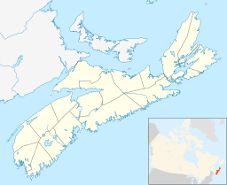
Franey Mountain is a cool spot located in Victoria County, Nova Scotia, Canada. It's part of the amazing Cape Breton Highlands National Park. This mountain is also a part of the Cape Breton Highlands plateau.
Franey Mountain sits about 4.5 kilometers (2.8 miles) west of a town called Ingonish on Cape Breton Island. The top of the mountain is about 430 meters (1,411 feet) high! It's the tallest point in the area between Dundas Brook and Clyburn Brook.
Hiking Franey Mountain
You can explore Franey Mountain by taking a fun hiking trail right to its top. Once you reach the summit, you'll see some incredible views! Imagine looking out over the huge Atlantic Ocean.
From the top, you can see all the way from Cape Smokey in the east to Money Point in the north. The Middle Head Peninsula sticks out into the ocean right below you. It's a truly amazing sight!
You'll also get a dramatic view of other mountains around you. The rocky face of Franey Mountain itself looks super impressive. And way down below, about 425 meters (1,394 feet) down, you can see the Clyburn Brook winding through the valley. Finding the very highest point on the mountain can be a bit tricky because the top is wide and flat.


