Franklin, Texas facts for kids
Quick facts for kids
Franklin, Texas
|
|
|---|---|
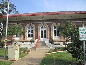
Carnegie Library in Franklin (2011)
|
|
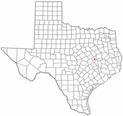
Location of Franklin within Texas
|
|
| Country | United States |
| State | Texas |
| County | Robertson |
| Founded | 1879 |
| Area | |
| • Total | 1.17 sq mi (3.03 km2) |
| • Land | 1.17 sq mi (3.03 km2) |
| • Water | 0.00 sq mi (0.00 km2) |
| Elevation | 443 ft (135 m) |
| Population
(2020)
|
|
| • Total | 1,614 |
| • Density | 1,405.98/sq mi (542.92/km2) |
| Time zone | UTC-6 (CST) |
| • Summer (DST) | UTC-5 (CDT) |
| ZIP code |
77856
|
| Area code | 979 |
| FIPS code | 48-27288 |
| GNIS feature ID | 2410540 |
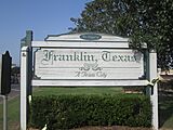
Franklin is a city in Texas, United States. It is the main town, or county seat, of Robertson County. Franklin is located in the Brazos Valley, which is a region between East and Central Texas. In 2020, about 1,614 people lived here. The town was first called Morgan and became the county seat in 1879.
Contents
Geography and Location
Franklin is located near the middle of Robertson County. It sits on a high, flat area of land. Water from this area flows into three different creeks. These creeks are Touchstone Branch, South Mineral Creek, and Cedar Creek.
According to the United States Census Bureau, the city covers about 1.17 square miles (3.03 square kilometers) of land. There is no water area within the city limits.
On April 13, 2019, a strong tornado passed through Franklin. This tornado caused a lot of damage and many people were hurt.
Weather in Franklin
| Climate data for Franklin, TX (1991-2020, coordinates:31°01′58″N 96°29′20″W / 31.0328°N 96.4889°W) | |||||||||||||
|---|---|---|---|---|---|---|---|---|---|---|---|---|---|
| Month | Jan | Feb | Mar | Apr | May | Jun | Jul | Aug | Sep | Oct | Nov | Dec | Year |
| Mean daily maximum °F (°C) | 60.0 (15.6) |
64.5 (18.1) |
71.3 (21.8) |
78.5 (25.8) |
84.7 (29.3) |
91.7 (33.2) |
95.2 (35.1) |
95.8 (35.4) |
90.6 (32.6) |
80.8 (27.1) |
69.3 (20.7) |
61.8 (16.6) |
78.7 (25.9) |
| Daily mean °F (°C) | 49.7 (9.8) |
54.0 (12.2) |
60.5 (15.8) |
67.6 (19.8) |
74.8 (23.8) |
81.6 (27.6) |
84.0 (28.9) |
84.5 (29.2) |
79.0 (26.1) |
69.5 (20.8) |
58.8 (14.9) |
51.3 (10.7) |
67.9 (20.0) |
| Mean daily minimum °F (°C) | 39.4 (4.1) |
43.5 (6.4) |
49.6 (9.8) |
56.8 (13.8) |
65.0 (18.3) |
71.4 (21.9) |
72.8 (22.7) |
73.1 (22.8) |
67.5 (19.7) |
58.1 (14.5) |
48.3 (9.1) |
40.9 (4.9) |
57.2 (14.0) |
| Average precipitation inches (mm) | 3.50 (89) |
2.84 (72) |
3.75 (95) |
2.68 (68) |
4.71 (120) |
3.68 (93) |
1.63 (41) |
3.04 (77) |
3.03 (77) |
4.68 (119) |
3.29 (84) |
3.78 (96) |
40.61 (1,031) |
| Average snowfall inches (cm) | 0.3 (0.76) |
0.3 (0.76) |
0.0 (0.0) |
0.0 (0.0) |
0.0 (0.0) |
0.0 (0.0) |
0.0 (0.0) |
0.0 (0.0) |
0.0 (0.0) |
0.0 (0.0) |
0.0 (0.0) |
0.0 (0.0) |
0.6 (1.52) |
| Average precipitation days (≥ 0.01 in) | 8.2 | 7.9 | 7.8 | 5.7 | 6.6 | 6.5 | 4.7 | 4.7 | 5.6 | 5.9 | 5.8 | 8.0 | 77.4 |
| Average snowy days (≥ 0.01 in) | 0 | 0.2 | 0 | 0 | 0 | 0 | 0 | 0 | 0 | 0 | 0 | 0 | 0.2 |
| Source: NOAA | |||||||||||||
Population and People
| Historical population | |||
|---|---|---|---|
| Census | Pop. | %± | |
| 1880 | 311 | — | |
| 1890 | 665 | 113.8% | |
| 1920 | 1,131 | — | |
| 1930 | 961 | −15.0% | |
| 1940 | 1,087 | 13.1% | |
| 1950 | 1,209 | 11.2% | |
| 1960 | 1,065 | −11.9% | |
| 1970 | 1,063 | −0.2% | |
| 1980 | 1,349 | 26.9% | |
| 1990 | 1,336 | −1.0% | |
| 2000 | 1,470 | 10.0% | |
| 2010 | 1,564 | 6.4% | |
| 2020 | 1,614 | 3.2% | |
| U.S. Decennial Census | |||
Franklin is part of the larger Bryan-College Station metropolitan area. This means it's connected to other nearby cities.
In 2020, there were 1,614 people living in Franklin. These people made up 555 households and 419 families. Most people in Franklin are White (about 65%), followed by Black or African American (about 18%), and Hispanic or Latino (about 12%).
In 2000, the city had 1,470 people. About 37% of households had children under 18 living with them. The average household had about 2.5 people. The average family had about 3.2 people.
The population was spread out by age. About 29% of the people were under 18 years old. About 20% were 65 years or older. The average age in the city was 37 years old.
Fun Places to Visit
Franklin has several interesting places to see:
- Pridgeon Community Center and Visitor Center
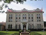
- Robertson County Courthouse – This old building is listed on the National Register of Historic Places.
- Franklin Ranch – A community and sports park.
- Franklin Carnegie Library – A historic library.
- Franklin Cemetery
Schools in Franklin
Students in Franklin attend schools that are part of the Franklin Independent School District. You can find more information on the Franklin ISD website. The district has three schools:
- Roland Reynolds Elementary: For students in Pre-Kindergarten through 4th grade.
- Franklin Middle School: For students in 5th through 8th grade.
- Franklin High School: For students in 9th through 12th grade.
The school district has about 1,100 students in total. Franklin High School has around 300 to 350 students.
Famous People from Franklin
Some notable people who have connections to Franklin include:
- Fred C. Cole, a librarian and historian.
- Felix Nelson, an actor.
- Derek Scott Jr., a racing driver.
Images for kids
See also
 In Spanish: Franklin (Texas) para niños
 | George Robert Carruthers |
 | Patricia Bath |
 | Jan Ernst Matzeliger |
 | Alexander Miles |


