
Freemans Bay facts for kids
Quick facts for kids
Freemans Bay
|
|
|---|---|
|
Suburb
|
|
 |
|

Freemans Bay
Location in New Zealand
|
|
| Country | New Zealand |
| Local authority | Auckland |
| Electoral ward | Waitematā and Gulf ward |
| Local board | Waitematā Local Board |
| Established | 1840s |
| Area | |
| • Land | 102 ha (252 acre) |
| Population
(June 2023)
|
|
| • Total | 4,210 |
|
|
||
Freemans Bay is a cool inner-city suburb in Auckland, New Zealand. It used to be a real bay, but over time, people filled it in with land. This means the old shoreline is now completely hidden! Long ago, it was known as a poorer area. But today, it's a popular and quite wealthy neighbourhood. People love it for its mix of old, historic houses and newer homes. It's also famous for its two big parks.
Contents
Freemans Bay Facts and Figures
Freemans Bay covers about 1.02 square kilometres. As of 2023, around 4,400 people live here. This means there are about 4,300 people living in each square kilometre.
| Historical population | ||
|---|---|---|
| Year | Pop. | ±% p.a. |
| 2006 | 3,831 | — |
| 2013 | 4,206 | +1.34% |
| 2018 | 4,407 | +0.94% |
In 2018, the population was 4,407. This was an increase of 201 people since 2013. The median age was about 37 years old. About 9% of the people were under 15 years old. Around 25% were aged 15 to 29. Most people, about 54%, were aged 30 to 64. About 12% were 65 or older.
Most people in Freemans Bay, about 80%, are of European descent. There are also people of Māori (8%), Pacific peoples (5%), and Asian (12%) backgrounds. About 35% of the people living here were born outside New Zealand.
When it comes to religion, many people (59%) said they had no religion. About 28% were Christian. Smaller numbers followed other religions like Hinduism, Islam, or Buddhism.
How Freemans Bay Changed Over Time

.jpg)
Since the early 1900s, a lot of land has been added to Freemans Bay. This was done by filling in the bay itself. They even used stones from nearby hills to do this! The filling of the old bay was finished in 1901. Most of this new flat land became Victoria Park. It's still a public space used mainly for sports today.
The coastline moved more than a kilometre away from the city centre. Now, it's made up of concrete wharves. These include the Viaduct Harbour and the Wynyard Quarter.
Freemans Bay's Past

Māori History
The Māori people had several names for the bay where Victoria Park now stands. One name was Waiatarau, meaning 'Reflecting Waters'. Other names included Wai Kōtota, which meant 'The place where cockles are harvested'. Te Koranga meant 'The scaffolds', referring to racks for drying fish. A stream called Waikuta ('Waters of the reed') flowed into the bay. Another stream, Tunamau ('To catch eels'), came down from what is now Western Park.
European Naming
Freemans Bay is one of the oldest settled areas in Auckland. Plans for its development and land reclamation began in the 1840s. These plans were made by Colonial Surveyor Felton Matthew.
The bay was likely named after Captain William Hobson’s secretary, James Stuart Freeman. He was a somewhat controversial figure at the time. He left New Zealand in 1845.
Industry and Housing
Even though Europeans settled here early, Freemans Bay was not always seen as a nice place to live. Wealthy people preferred to live on the other side of Queen Street. They enjoyed views of the harbour and Rangitoto Island. This was even called the 'right side' of Queen Street.
On the "wrong side of Queen Street" were many noisy and smelly industries. These included an abattoir (where animals are processed) and a gasworks. There were also shipyards, sawmills, and a foundry. Public facilities like the city morgue and a rubbish incinerator were also located here. The incinerator, known as the 'Destructor', is now Victoria Park Market.
Around these industries were smaller, simpler houses. These workers' cottages were often built very close together. Some were not very well built. However, on Franklin Road, which goes up a hill, larger houses were built. Some of these became boarding houses for workers. In 1910, a house on Franklin Road cost about £736. A house in a wealthier area like Remuera cost much more, around £1279.
In 1905, Victoria Park was created. It included sports grounds, a sports pavilion, and a children's playground. A kindergarten for local children opened in 1909. The brick building for the kindergarten has been restored by Auckland Council.
Modern Changes
Freemans Bay was a working-class area. It was hit hard by the Great Depression in the 1930s. When the motorway system was built from 1955 onwards, it led to many old buildings being pulled down. The motorway cut through large parts of Freemans Bay.
During the 1960s and 1970s, new flats and townhouses were built. Later, in the 1980s and 1990s, the remaining Victorian houses became very popular. This process is called gentrification. Now, these homes are some of Auckland's most fashionable places to live.
On Victoria Street, across from Victoria Park, are old brick industrial buildings. These were built between 1905 and 1915. They were known as "the Destructor" because they burned the city's rubbish to make electricity. It closed in 1972. In 1983, it was turned into a market called Victoria Park Market.
The Drake Hotel is behind Victoria Park Market. It sits a bit higher, showing where the old sea cliff used to be. After 1905, Freemans Bay was filled in to create the park. Later, more land was added north of the park for wharves.
From 2000 to 2003, the Lighter Basin area was redeveloped into the Viaduct Harbour. This area was used for the America's Cup yachting races. Now, it's a fancy residential area with multi-story buildings. Nearby, old warehouses have been replaced by modern office blocks. The Wynyard Quarter is also being redeveloped, including the new Silo Park.
Today, Freemans Bay is home to wealthier residents. The median income here is higher than the Auckland average. Many different types of homes can be found in the area.
Cool Buildings to See
- The Drake Hotel: This old Victorian pub stands where the sea cliff used to be. It's a historic spot.
- Victoria Park Market: This building was originally a city rubbish incinerator, built between 1905 and 1915. It was called 'The Destructor'. It generated electricity by burning rubbish. It closed in 1972 but was saved from demolition. In 1983, it reopened as Victoria Park Market.
- Former Campbell Kindergarten: This brick building is on the south side of Victoria Park. It was paid for by Sir John Logan Campbell. It has been restored as part of the Victoria Park Tunnel project.
- Birdcage Hotel: Also known as the Rob Roy Hotel, this Victorian pub was built in 1885-1886. It used to be right on the quayside. To save it during the Victoria Park Tunnel construction, the entire building (except the basement) was moved 40 metres along Franklin Road in 2011!
- Former Gasworks: On Beaumont Street, these elegant brick buildings have been turned into shops and apartments.
- Former Caretakers Cottage: This Arts & Crafts style cottage is in the north-east corner of Victoria Park. It has been restored and is now a cafe.
- Sports Pavilion: This building in Victoria Park was replaced in the 1990s. During the 1918 flu epidemic, it was used to store bodies before they were taken to cemeteries.
- Auckland Girls' Grammar School: Located on Howe Street, this brick building was built in 1909. It's on the site of old immigration barracks.
- Te Kainga Aroha: At 29 Hepburn Street, this 1890s wooden house is in the Queen Anne style. It has been a girls' hostel since the 1940s.
- Queens Hall: This brick and stucco concert hall at 9 Paget Street was built in the 1880s.
- Blomfield House: At 40 Wood Street, this two-story wooden house was built for the famous landscape painter Charles Blomfield (artist). It was supposedly built from a single kauri tree!
- McGregor House: At 2 Franklin Road, this unique wooden house with a turret was built for one of Alexander McGregor's sons. It is now a backpackers' hostel.
- Sinclair House: At 68 Franklin Road, this two-story brick house is unusual for the area. The TV presenter Peter Sinclair used to own it.
Schools in Freemans Bay
Freemans Bay School is a primary school for students in years 1 to 6. It has a roll of around 500 students.
For secondary school, students can attend nearby Auckland Girls' Grammar School. Boys can go to the Catholic St Paul's College, and girls can go to St Mary's College.
Images for kids
-
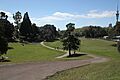
Lower Western Park.
