Freiberg Rural District facts for kids
Quick facts for kids
Freiberg
|
|
|---|---|
 |
|
| Country | |
| State | Saxony |
| Adm. region | Chemnitz |
| Capital | Freiberg |
| Area | |
| • Total | 914 km2 (353 sq mi) |
| Population
(2001)
|
|
| • Total | 151,600 |
| • Density | 165.86/km2 (429.6/sq mi) |
| Time zone | UTC+1 (CET) |
| • Summer (DST) | UTC+2 (CEST) |
| Vehicle registration | FG |
| Website | freiberg-regional.de |
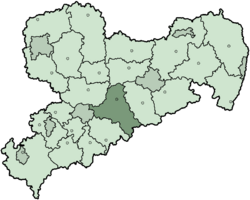
Freiberg is a rural district located in the Free State of Saxony, a state in Germany. It's like a large county that groups together many smaller towns and villages. This area is known for its rich history, especially its mining traditions.
History of Freiberg District
The Freiberg district was created in 1994. Before that, there were three separate districts. These were Freiberg, Brand-Erbisdorf, and Flöha. They all joined together to form the single, larger Freiberg district we know today.
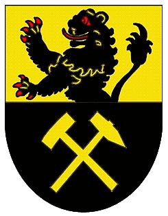
What the Coat of Arms Means
A coat of arms is a special symbol for a place. It often tells a story about its history or features.
The coat of arms for the Freiberg district shows two main things:
- The lion is a very old symbol. It represents Saxony, which is the state where Freiberg is located.
- The tools you see are mining tools. They remind everyone of the long history of mining in the Ore Mountains area. Mining was very important here for many years.
Towns and Communities in Freiberg
The Freiberg district is made up of several towns and many smaller communities. These are the places where people live and work within the district.
| Towns | Municipalities | |
|---|---|---|
|
|
|
 | James Van Der Zee |
 | Alma Thomas |
 | Ellis Wilson |
 | Margaret Taylor-Burroughs |


