
Făgăraș Mountains facts for kids
Quick facts for kids Făgăraș Mountains |
|
|---|---|
| Romanian: Munții Făgăraș Hungarian: Fogaras hegység |
|

Relief map - Tourist Map
|
|
| Highest point | |
| Peak | Moldoveanu |
| Elevation | 2,544 m (8,346 ft) |
| Geography | |
| Country | Romania |
| Parent range | Carpathians |
| Geology | |
| Orogeny | Alpine orogeny |
| Age of rock | Mostly Triassic |

The Făgăraș Mountains (Romanian: Munții Făgărașului; Hungarian: Fogarasi-havasok) are the highest mountains in Romania. They are part of the Southern Carpathians mountain range. These mountains are often called the "Transylvanian Alps" because of their tall, rugged peaks and beautiful scenery. They are a very popular place for outdoor adventures.
Contents
Exploring the Făgăraș Mountains' Location
The Făgăraș Mountains are located right in the middle of Romania. You can find them at about 45°35′N 24°45′E on a map.
Where are the Făgăraș Mountains?
To the north, the mountains are next to an area called the Făgăraș Depression. The Olt River flows through this depression. To the west, the mountains end at the Olt Valley. Even though the town of Făgăraș shares its name, it is about 20 kilometers (12 miles) north and not the closest town to the mountains. There are no big towns right in the mountain range itself. Other important cities nearby include Brașov and Sibiu.
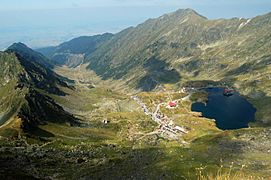
Amazing Glacier Lakes of Făgăraș
The Făgăraș Mountains are home to several beautiful lakes. These lakes were formed by glaciers long ago.
- Bâlea Lake is the largest glacier lake. It sits at 2,034 meters (6,673 feet) high. It covers an area of 46,508 square meters (about 11.5 acres) and is 11.35 meters (37 feet) deep.
- The highest lake is in the Hărtopul Leaotei glacial valley.
- Podragu Lake is the deepest glacier lake. It is at 2,140 meters (7,021 feet) high and is 15.5 meters (51 feet) deep.
- Other notable lakes include Urlea (2,170 meters high) and Capra (2,230 meters high).
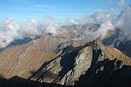
Highest Peaks in the Făgăraș Mountains
The Făgăraș Mountains have many tall peaks. Here are some of the highest ones:
- Moldoveanu — 2,544 meters (8,346 feet)
- Negoiu — 2,535 meters (8,317 feet)
- Viștea Mare — 2,527 meters (8,291 feet)
- Lespezi — 2,516 meters (8,255 feet)
- Cornul Călțunului — 2,510 meters (8,235 feet)
- Vânătoarea lui Buteanu — 2,507 meters (8,225 feet)
- Hârtopul Darei — 2,506 meters (8,222 feet)
- Dara — 2,501 meters (8,205 feet)
- Scărișoara Mare — 2,495 meters (8,186 feet)
- Mușetescu — 2,495 meters (8,186 feet)
- Capra — 2,494 meters (8,182 feet)
- Roșu — 2,489 meters (8,166 feet)
- Negoiu Mic — 2,485 meters (8,153 feet)
- Podragu — 2,482 meters (8,143 feet)
- Urlea — 2,473 meters (8,114 feet)
Accessing and Enjoying the Făgăraș Mountains

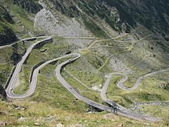
The most common way to get into these mountains is by using the Transfăgărășan road. This famous road crosses right over the Făgăraș range. It is usually open only from June to September. This is because the weather conditions, like heavy snow, make it too dangerous to drive on for the rest of the year.
Popular Activities in Făgăraș
The Făgăraș Mountains are a very popular spot for outdoor activities in Romania. Many people come here for hiking, trekking, and skiing. If you want to hike to Moldoveanu Peak, a common starting point is the town of Victoria. For other parts of the Făgăraș Mountains, people often start from Arpașu de Jos, Porumbacu de Jos, and Avrig.
Challenging Trails for Hikers
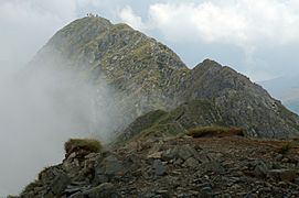
Some parts of the mountains, especially near Negoiu Peak and in the central area, are very rocky. Hiking on the main ridge trail can be challenging and requires careful steps. One difficult part of the trail is called "Three steps from the death." This section runs along the main ridge by Custura Arpașului to Capra Lake (2,230 meters high). Another challenging path to Negoiu is called Strunga Dracului. The most difficult section of the ridge is Custura Sărății, between Șerbota (2,331 meters high) and Șaua Cleopatrei pass (2,355 meters high). Some parts have steel cables to help hikers, but many sections do not have any artificial aids.
Discussions About the Future of Făgăraș
In 2016, there was a plan to make the Făgăraș Mountains a national park. This idea caused some disagreements. Local people wanted to keep their access to timber and forest products. The land in the mountains is owned in different ways, so only a part of it could become a national park at first. Private investments helped with this.
There are also plans to build a ski resort in the area. People who want to protect nature are against this idea. However, many people living in the nearby towns support the ski resort. They hope it will bring more jobs and better economic opportunities to the region.
Image gallery
-
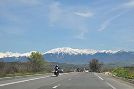
Towards the mountains
-
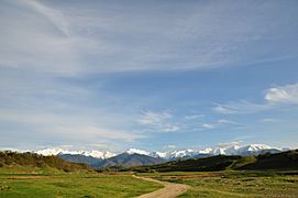
View from Sărata
-
Făgăraș Mountains as viewed from Negoiu
-
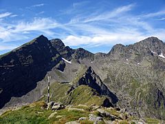
Negoiu Peak (2535m)
-
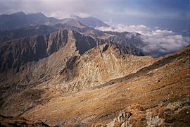
Amphitheatre
-
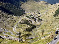
Transfăgărășan road DN7C
-
Moldoveanu peak and Viștea shelter
-
Făgăraș Mountains seen from Olt
-
Lake Bâlea
-
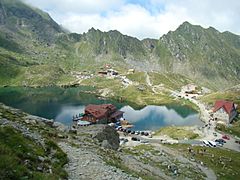
Bâlea lodge
-
Moldoveanu from Viștea Mare peak
-
Făgăraș Mountains - from above 2000m, towards Moldoveanu Peak (farthest in the image)
-
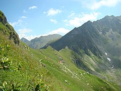
Hiking in Făgăraș Mountains
-
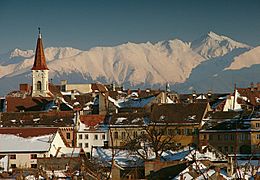
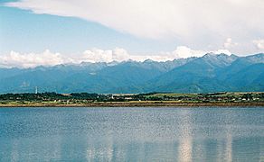
Făgăraș as seen from Sibiu
-
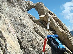
Fereastra Zmeilor rock formations
-
-
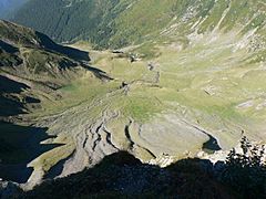
View towards a glacial valley
-
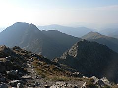
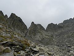
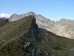
Mountain crests
-
-
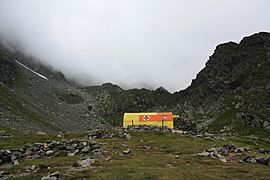
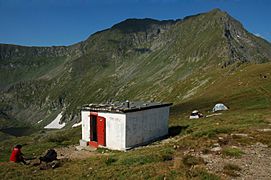
Călțun refuge


_44.jpg)


_67.jpg)


_27.jpg)
_61.jpg)


See also
 In Spanish: Montañas Făgăraș para niños
