Gainesville, New York facts for kids
Quick facts for kids
Gainesville
|
|
|---|---|

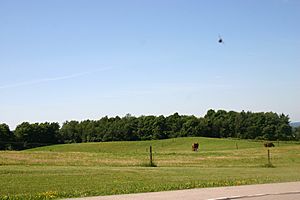
The ice age left rolling, but fertile land
|
|

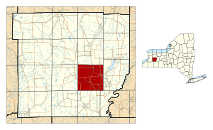
Location within Wyoming County and New York
|
|
| Country | United States |
| State | New York |
| County | Wyoming |
| Area | |
| • Total | 35.71 sq mi (92.48 km2) |
| • Land | 35.57 sq mi (92.13 km2) |
| • Water | 0.14 sq mi (0.36 km2) |
| Elevation | 1,660 ft (510 m) |
| Population
(2010)
|
|
| • Total | 2,182 |
| • Estimate
(2016)
|
2,118 |
| • Density | 59.54/sq mi (22.99/km2) |
| Time zone | UTC-5 (Eastern (EST)) |
| • Summer (DST) | UTC-4 (EDT) |
| FIPS code | 36-27980 |
| GNIS feature ID | 978982 |
Gainesville is a town located in Wyoming County, New York. In 2010, about 2,182 people lived here. The town is named after General Edmund P. Gaines.
The Town of Gainesville is found on the eastern side of Wyoming County. There is also a village called Gainesville within the town.
Contents
Discovering Gainesville's Past
The Town of Gainesville was created in 1814. It was formed from a part of the Town of Warsaw. Its first name was "Hebe."
Gainesville is known as the birthplace of some important people. David Starr Jordan was born here; he became the first president of Stanford University. Also, Ella Hawley Crossett, a key activist in the women's suffrage movement, was from Gainesville. She worked to help women gain the right to vote.
Exploring Gainesville's Geography
Gainesville covers about 35.7 square miles (92.5 km2). Most of this area, about 35.6 square miles (92.2 km2), is land. A small part, about 0.1 square mile (0.3 km2), is water.
This area is mostly rural, meaning it has many farms and forests. For a long time, it has been known for its dairy farms. The soil here is rich and good for growing crops. It was shaped by the last ice age, which left the land gently rolling and a bit rocky.
Understanding Gainesville's Population
| Historical population | |||
|---|---|---|---|
| Census | Pop. | %± | |
| 1830 | 1,820 | — | |
| 1840 | 2,367 | 30.1% | |
| 1850 | 1,760 | −25.6% | |
| 1860 | 1,732 | −1.6% | |
| 1870 | 1,612 | −6.9% | |
| 1880 | 1,787 | 10.9% | |
| 1890 | 2,166 | 21.2% | |
| 1900 | 2,325 | 7.3% | |
| 1910 | 2,690 | 15.7% | |
| 1920 | 2,276 | −15.4% | |
| 1930 | 2,074 | −8.9% | |
| 1940 | 1,923 | −7.3% | |
| 1950 | 2,121 | 10.3% | |
| 1960 | 2,032 | −4.2% | |
| 1970 | 2,177 | 7.1% | |
| 1980 | 2,133 | −2.0% | |
| 1990 | 2,288 | 7.3% | |
| 2000 | 2,333 | 2.0% | |
| 2010 | 2,182 | −6.5% | |
| 2016 (est.) | 2,118 | −2.9% | |
| U.S. Decennial Census | |||
In the year 2000, there were 2,333 people living in Gainesville. These people lived in 873 households. A household means all the people living in one home.
About 37% of the households had children under 18 years old. Most households, 58.4%, were married couples living together. The average household had about 2.67 people.
Communities and Places in Gainesville
The Town of Gainesville includes several smaller communities and locations:
- Gainesville – This is the main village within the town.
- Gainesville Center – You can find this spot west of Gainesville village, along Route 78.
- Hardy's – This location is in the southwest part of the town.
- Newburg – This is a small community, called a hamlet, located on Route 19 near the northern town line.
- North Gainesville – This area is west of Newburg.
- Rock Glen – Another hamlet found on Route 19, also near the northern town line.
- Silver Springs – This is another village located within the Town of Gainesville.
See also
 In Spanish: Gainesville (Nueva York) para niños

