Garleton Hills facts for kids
Quick facts for kids Garleton Hills |
|
|---|---|

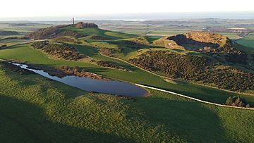
Garleton Hills and Hopetoun Monument
|
|
| Highest point | |
| Peak | Skid Hill |
| Elevation | 186 m (610 ft) |
| Prominence | 98 |
| Geography | |
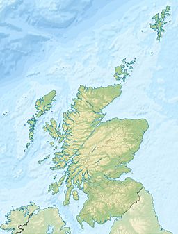
| Location | East Lothian |
| Country | United Kingdom |
| State/Province | Scotland |
| Geology | |
| Age of rock | Carboniferous |
The Garleton Hills are a range of hills in East Lothian, Scotland. They are made of igneous rocks, which means they were formed from cooled lava or magma. You can find them just north of the town of Haddington.
Contents
Exploring the Garleton Hills
Even though Skid Hill, the highest point, is only 186 meters (610 feet) tall, these hills really stand out across the whole area. They are easy to spot from far away!
Famous Landmarks on the Hills
On the western side of the hills, you'll see the Hopetoun Monument. This monument honors John, 4th Earl of Hopetoun. He was an important leader in the British Army during the Peninsular War. This war took place in Spain and Portugal in the early 1800s.
You can also find two old castles on the Garleton Hills. Barnes Castle is located on the southern slopes. On the northern slopes, you'll find Garleton Castle.
How the Garleton Hills Were Formed
The Garleton Hills form a clear ridge, which is like a long, narrow hilltop. From the top, you get amazing views over the flatter parts of East Lothian.
Rocks and Layers
These hills are made from different layers of igneous rocks. These rocks formed during the Carboniferous period, which was about 359 to 299 million years ago. Some of these rock layers are harder than others, which means they wear away differently over time.
For example, there's hard basalt rock lying over trachytic lavas. Basalt is a dark, fine-grained volcanic rock. Trachytic lavas are also volcanic but have a different texture.
Ice and Erosion
Over many years, especially during ice ages, glaciers moved across the land. This ice helped shape the hills. The ice wore away the softer rocks more easily than the harder ones.
The trachytic lavas, for instance, slope towards the south-southeast. The ice shaped them into cuestas, which are like steps or ridges with one steep side and one gentle slope. The Garleton Hills have a steep side facing north and a gentler slope facing south.
The movement of ice and melting water also carved out grooves and channels along the hills. Near the village of Athelstaneford, there's a bowl-shaped area called a rock basin. This basin was partly dug out of the softer basalt rocks by the ice.
Protecting the Hills
The Garleton Hills are very important for understanding geology. That's why Scottish Natural Heritage has named them a Geological Conservation Review site. They are also a Site of Special Scientific Interest (SSSI), which means they are protected because of their special natural features.
 | Jewel Prestage |
 | Ella Baker |
 | Fannie Lou Hamer |


