Gaynor, Missouri facts for kids
Quick facts for kids
Gaynor, Missouri
|
|
|---|---|
 |
|

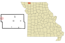
Location of Gaynor, Missouri
|
|
| Country | United States |
| State | Missouri |
| County | Worth |
| Area | |
| • Total | 0.19 sq mi (0.50 km2) |
| • Land | 0.19 sq mi (0.50 km2) |
| • Water | 0.00 sq mi (0.00 km2) |
| Elevation | 1,211 ft (369 m) |
| Population
(2010)
|
|
| • Total | 12 |
| • Estimate
(2019)
|
12 |
| • Density | 922.68/sq mi (355.69/km2) |
| Time zone | UTC-6 (Central (CST)) |
| • Summer (DST) | UTC-5 (CDT) |
| ZIP code |
64486
|
| Area code(s) | 660 |
| FIPS code | 29-67358 |
| GNIS feature ID | 740868 |
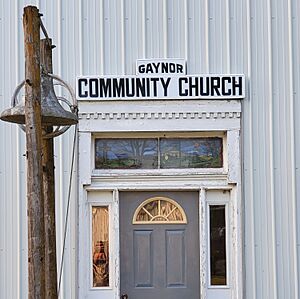
Gaynor is a small, unincorporated community located in Nodaway County, in the U.S. state of Missouri. An unincorporated community means it's a place where people live, but it doesn't have its own local government like a city or town. Instead, it's usually governed by the county.
History
The community of Gaynor has an interesting past. It was once known by a slightly different name: "Gaynor City."
Early Days and the Post Office
A post office, which is a place where mail is sent and received, was first opened in Gaynor City in 1879. This was an important service for the people living there.
Name Change and Closure
In 1895, the name of the post office, and therefore the community, was officially changed from Gaynor City to just Gaynor. However, the post office eventually closed its doors in 1903.
Who Was Edward Gaynor?
The community was named after a local person named Edward Gaynor. He was a tradesman, which means he worked in a skilled job or craft, serving the needs of the people in the area.
 | James Van Der Zee |
 | Alma Thomas |
 | Ellis Wilson |
 | Margaret Taylor-Burroughs |

