
Gays Mills, Wisconsin facts for kids
Quick facts for kids
Gays Mills, Wisconsin
|
|
|---|---|
|
Village
|
|

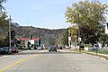
Looking east at downtown Gays Mills in 2010
|
|

Location of Gays Mills in Crawford County, Wisconsin.
|
|
| Country | |
| State | |
| County | Crawford |
| Area | |
| • Total | 4.90 sq mi (12.69 km2) |
| • Land | 4.87 sq mi (12.62 km2) |
| • Water | 0.03 sq mi (0.07 km2) |
| Elevation | 702 ft (214 m) |
| Population
(2020)
|
|
| • Total | 523 |
| • Density | 106.73/sq mi (41.21/km2) |
| Time zone | UTC-6 (Central (CST)) |
| • Summer (DST) | UTC-5 (CDT) |
| Area code(s) | 608 |
| FIPS code | 55-28450 |
| GNIS feature ID | 1565448 |
Gays Mills is a small village located in Crawford County, Wisconsin, in the United States. In 2020, about 523 people lived there. It is known for its history and its efforts to deal with flooding from the Kickapoo River.
Contents
The History of Gays Mills

Gays Mills got its start in 1847. A man named James B. Gay built a dam and a sawmill on the Kickapoo River. This mill was very successful. Later, his brothers John and Thomas Gay joined him.
In 1865, John Gay built the first flour mill in the area. In 1872, Thomas Gay and his family helped start the First Congregational Church. The church building was finished in 1898. Many families moved to the area between 1848 and 1865. The community became known as Gays Mills, honoring the Gay brothers who helped it grow.
Gays Mills also became famous for its apples. The Twining family, who grew apples there, even took their apples to the World's Fair. They were a big hit! Today, many apple orchards surround the village in Crawford County.
Dealing with Flooding


Gays Mills has faced challenges with flooding from the Kickapoo River. In 2007 and 2008, nearly 60 homes were badly damaged by floods. These repeated floods hurt the local economy.
Because of this, people started talking about moving the village to higher ground. In 2008, the Federal Emergency Management Agency (FEMA) suggested that homes and businesses move away from the river's flood plain. About 150 of the village's 230 houses were in this flood-prone area.
In 2010, the village received a large grant of $4.31 million. This money was to help move the village's business area out of the flood zone. Even after these efforts, Gays Mills experienced more flooding in 2016, 2017, and 2018.
Geography of Gays Mills
Gays Mills is located at 43°19′6″N 90°50′48″W / 43.31833°N 90.84667°W. The village covers an area of about 4.90 square miles (12.69 square kilometers). Most of this area is land, with a small part being water.

Climate and Weather
Gays Mills has a type of climate called a hot-summer humid continental climate. This means it has warm, humid summers and cold winters.
The hottest temperature ever recorded in Gays Mills was 103°F (39°C) on August 14, 1998. The coldest temperature ever recorded was a very chilly -48°F (-44°C) in February 1996.
| Climate data for Gays Mills, Wisconsin, 1991–2020 normals, extremes 1986–present | |||||||||||||
|---|---|---|---|---|---|---|---|---|---|---|---|---|---|
| Month | Jan | Feb | Mar | Apr | May | Jun | Jul | Aug | Sep | Oct | Nov | Dec | Year |
| Record high °F (°C) | 57 (14) |
68 (20) |
82 (28) |
89 (32) |
96 (36) |
100 (38) |
102 (39) |
103 (39) |
93 (34) |
89 (32) |
75 (24) |
69 (21) |
103 (39) |
| Mean maximum °F (°C) | 45.8 (7.7) |
51.5 (10.8) |
66.4 (19.1) |
79.2 (26.2) |
86.3 (30.2) |
91.1 (32.8) |
92.1 (33.4) |
90.9 (32.7) |
87.3 (30.7) |
80.5 (26.9) |
64.5 (18.1) |
50.8 (10.4) |
94.1 (34.5) |
| Mean daily maximum °F (°C) | 27.3 (−2.6) |
32.1 (0.1) |
44.8 (7.1) |
58.3 (14.6) |
70.1 (21.2) |
79.7 (26.5) |
83.2 (28.4) |
81.5 (27.5) |
74.2 (23.4) |
60.9 (16.1) |
45.3 (7.4) |
32.7 (0.4) |
57.5 (14.2) |
| Daily mean °F (°C) | 17.1 (−8.3) |
21.5 (−5.8) |
34.1 (1.2) |
46.4 (8.0) |
58.0 (14.4) |
68.2 (20.1) |
72.0 (22.2) |
70.2 (21.2) |
62.0 (16.7) |
49.1 (9.5) |
35.8 (2.1) |
23.9 (−4.5) |
46.5 (8.1) |
| Mean daily minimum °F (°C) | 7.0 (−13.9) |
10.9 (−11.7) |
23.4 (−4.8) |
34.5 (1.4) |
46.0 (7.8) |
56.7 (13.7) |
60.9 (16.1) |
58.9 (14.9) |
49.9 (9.9) |
37.3 (2.9) |
26.3 (−3.2) |
15.1 (−9.4) |
35.6 (2.0) |
| Mean minimum °F (°C) | −20.4 (−29.1) |
−11.9 (−24.4) |
−0.4 (−18.0) |
18.9 (−7.3) |
29.8 (−1.2) |
41.7 (5.4) |
49.1 (9.5) |
47.4 (8.6) |
34.0 (1.1) |
21.9 (−5.6) |
8.2 (−13.2) |
−8.9 (−22.7) |
−24.8 (−31.6) |
| Record low °F (°C) | −45 (−43) |
−48 (−44) |
−23 (−31) |
10 (−12) |
20 (−7) |
34 (1) |
44 (7) |
38 (3) |
24 (−4) |
9 (−13) |
−10 (−23) |
−33 (−36) |
−48 (−44) |
| Average precipitation inches (mm) | 1.32 (34) |
1.17 (30) |
2.03 (52) |
3.89 (99) |
4.24 (108) |
5.56 (141) |
4.83 (123) |
4.43 (113) |
3.90 (99) |
2.68 (68) |
2.10 (53) |
1.55 (39) |
37.70 (958) |
| Average snowfall inches (cm) | 10.8 (27) |
7.8 (20) |
5.9 (15) |
1.6 (4.1) |
0.0 (0.0) |
0.0 (0.0) |
0.0 (0.0) |
0.0 (0.0) |
0.0 (0.0) |
0.1 (0.25) |
1.9 (4.8) |
9.7 (25) |
37.8 (96.15) |
| Average precipitation days (≥ 0.01 in) | 8.1 | 6.4 | 7.6 | 9.2 | 10.7 | 10.6 | 8.4 | 8.1 | 8.2 | 7.8 | 6.6 | 7.2 | 98.9 |
| Average snowy days (≥ 0.1 in) | 6.0 | 4.7 | 3.0 | 0.8 | 0.0 | 0.0 | 0.0 | 0.0 | 0.0 | 0.1 | 1.7 | 5.0 | 21.3 |
| Source 1: NOAA | |||||||||||||
| Source 2: National Weather Service | |||||||||||||
Population and People
| Historical population | |||
|---|---|---|---|
| Census | Pop. | %± | |
| 1910 | 557 | — | |
| 1920 | 652 | 17.1% | |
| 1930 | 579 | −11.2% | |
| 1940 | 737 | 27.3% | |
| 1950 | 662 | −10.2% | |
| 1960 | 634 | −4.2% | |
| 1970 | 623 | −1.7% | |
| 1980 | 627 | 0.6% | |
| 1990 | 578 | −7.8% | |
| 2000 | 625 | 8.1% | |
| 2010 | 491 | −21.4% | |
| 2020 | 523 | 6.5% | |
| U.S. Decennial Census | |||
Demographics is the study of a population's characteristics. In 2010, Gays Mills had 491 people living in 226 households.
- About 25.7% of households had children under 18.
- Most people (97.1%) were White.
- The average age in the village was 47.5 years old.
- About 23.8% of residents were under 18 years old.
- More females (54.2%) lived in the village than males (45.8%).
Images for kids
-
Looking west at downtown Gays Mills in 2010
-
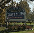
City welcome sign
-
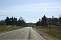
Sign for Gays Mills on WIS 131
-
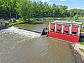
Dam on the Kickapoo River
-
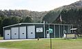
Fire department
-
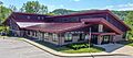
Village Hall, library, and community kitchen


See also
 In Spanish: Gays Mills para niños
