Geishouse facts for kids
Quick facts for kids
Geishouse
|
||
|---|---|---|
|
||
| Country | France | |
| Region | Grand Est | |
| Department | Haut-Rhin | |
| Arrondissement | Thann-Guebwiller | |
| Canton | Cernay | |
| Intercommunality | Vallée de Saint-Amarin | |
| Area
1
|
7.28 km2 (2.81 sq mi) | |
| Population
(2006)
|
495 | |
| • Density | 67.99/km2 (176.10/sq mi) | |
| Time zone | UTC+01:00 (CET) | |
| • Summer (DST) | UTC+02:00 (CEST) | |
| INSEE/Postal code |
68102 /68690
|
|
| Elevation | 510–1,422 m (1,673–4,665 ft) (avg. 730 m or 2,400 ft) |
|
| 1 French Land Register data, which excludes lakes, ponds, glaciers > 1 km2 (0.386 sq mi or 247 acres) and river estuaries. | ||
Geishouse is a small village located in eastern France. It is known as a commune, which is like a local government area. Geishouse is part of the Haut-Rhin department. This department is a region within France, similar to a county or state.
Contents
Exploring Geishouse: Location and Size
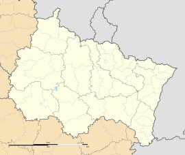
Geishouse is found in the Haut-Rhin department. This area is in the Grand Est region of France. The village covers an area of about 7.28 square kilometers. That's roughly 2.8 square miles.
Where is Geishouse Located?
Geishouse is situated in the Thann-Guebwiller arrondissement. An arrondissement is a type of administrative district in France. It is also part of the Cernay canton. A canton is another smaller administrative division.
How Many People Live in Geishouse?
As of 2006, the population of Geishouse was 495 people. This makes it a very small and quiet community. The people living there are called its residents.
Understanding Geishouse's Geography
Geishouse is located in a hilly or mountainous area. Its elevation ranges from 510 meters to 1422 meters above sea level. The average elevation is about 730 meters. This high elevation suggests beautiful natural surroundings.
What is the Elevation of Geishouse?
The lowest point in Geishouse is 510 meters (about 1,673 feet). The highest point reaches 1422 meters (about 4,665 feet). This wide range means the landscape is varied. You might find valleys and higher peaks within the commune.
Local Government in Geishouse
Like all communes in France, Geishouse has its own local government. This government helps manage the daily life of the village. It takes care of things like local services and public spaces.
Who is the Mayor of Geishouse?
The mayor of Geishouse is Gilles Steger. He served as mayor from 2008 to 2014. The mayor is the head of the local government. They are responsible for leading the commune.
What is Intercommunality?
Geishouse is part of an intercommunality called Vallée de Saint-Amarin. Intercommunality means that several communes work together. They share resources and services. This helps small villages like Geishouse get better services.
See also
 In Spanish: Geishouse para niños
 | Dorothy Vaughan |
 | Charles Henry Turner |
 | Hildrus Poindexter |
 | Henry Cecil McBay |


