Gennetines facts for kids
Quick facts for kids
Gennetines
|
||
|---|---|---|

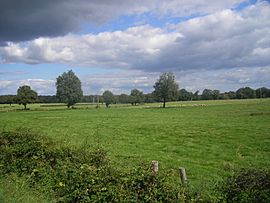
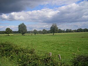
The landscape around Gennetines
|
||
|
||
| Country | France | |
| Region | Auvergne-Rhône-Alpes | |
| Department | Allier | |
| Arrondissement | Moulins | |
| Canton | Yzeure | |
| Intercommunality | Moulins | |
| Area
1
|
39.14 km2 (15.11 sq mi) | |
| Population
(Jan. 2019)
|
647 | |
| • Density | 16.530/km2 (42.81/sq mi) | |
| Time zone | UTC+01:00 (CET) | |
| • Summer (DST) | UTC+02:00 (CEST) | |
| INSEE/Postal code |
03121 /03400
|
|
| Elevation | 224–267 m (735–876 ft) (avg. 247 m or 810 ft) |
|
| 1 French Land Register data, which excludes lakes, ponds, glaciers > 1 km2 (0.386 sq mi or 247 acres) and river estuaries. | ||
Gennetines is a small commune (a type of town or village) located in the center of France. It is part of the Allier department, which is like a county in other countries.
Contents
About Gennetines
Gennetines is a quiet place in the Auvergne region of France. It is known for its peaceful countryside and traditional French charm. The area around Gennetines features beautiful landscapes, perfect for exploring.
Where is Gennetines?
Gennetines is found in the Allier department. This department is in the central part of France. The closest large town is Moulins, which is also the main city for the area.
Population and Size
As of January 2019, about 647 people lived in Gennetines. This makes it a small community. The commune covers an area of about 39.14 square kilometers (about 15 square miles). This means there's plenty of open space and nature around the village.
Local Government
Like all French communes, Gennetines has a mayor who leads the local government. The mayor helps manage the town's services and represents its people. The current mayor is Noël Prugnaud. He was elected to serve from 2014 to 2020.
Gennetines is also part of a larger administrative area called an arrondissement, which is Moulins. It belongs to the canton of Yzeure. These divisions help organize local services and elections.
Geography and Landscape
The land in Gennetines is mostly flat or gently rolling. The elevation, or height above sea level, ranges from about 224 meters (735 feet) to 267 meters (876 feet). The average elevation is around 247 meters (810 feet). This makes the area suitable for farming and enjoying nature.
See also
 In Spanish: Gennetines para niños


