Geyserville, California facts for kids
Quick facts for kids
Geyserville
|
|
|---|---|

Geyserville, California
|
|
| Country | |
| State | |
| County | Sonoma |
| Area | |
| • Total | 4.588 sq mi (11.882 km2) |
| • Land | 4.588 sq mi (11.882 km2) |
| • Water | 0 sq mi (0 km2) 0% |
| Elevation | 213 ft (65 m) |
| Population
(2010)
|
|
| • Total | 862 |
| • Density | 187.88/sq mi (72.55/km2) |
| Time zone | UTC-8 (PST) |
| • Summer (DST) | UTC-7 (PDT) |
| ZIP code |
95441
|
| Area code(s) | 707 |
| FIPS code | 06-29420 |
| GNIS feature ID | 224138 |
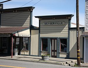
Geyserville (which used to be called Clairville) is a small community in Sonoma County, California, USA. It's a "census-designated place" (CDP), which means it's a special area defined by the government for counting people.
Geyserville is located in a beautiful part of California known as the Wine Country. It has a few restaurants, cozy places to stay called bed and breakfasts, and many wineries. You can find Geyserville easily because it's close to two main roads: California State Route 128 and US Route 101. In 2010, about 862 people lived there.
Contents
History of Geyserville
Geyserville was built on land that was once part of a large Mexican land grant called Rancho Tzabaco. The town started because of an exciting discovery in 1847. People found hot springs, steam vents, and places where steam came out of the ground in the mountains nearby. This area became known as The Geysers.
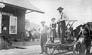
The Geysers quickly became a popular place for tourists to visit. So, a small settlement grew up to offer places for visitors to stay and to serve as a starting point for trips to The Geysers. At first, this settlement was called Clairville. But later, it was renamed Geyserville, after the famous hot springs.
In the 1870s, a train line called the San Francisco and North Pacific Railroad was built. Its trains started stopping in Geyserville, which helped the town grow even more.
Geography of Geyserville
Geyserville is a "census-designated place" (CDP). This means it's an area that the United States Census Bureau defines for gathering population data, even though it's not an officially incorporated city or town.
The CDP of Geyserville covers an area of about 4.6 square miles (11.9 square kilometers). All of this area is land; there are no large bodies of water within its boundaries.
People of Geyserville
| Historical population | |||
|---|---|---|---|
| Census | Pop. | %± | |
| 1990 | 628 | — | |
| 2010 | 862 | — | |
| 2020 | 861 | −0.1% | |
| 2024 (est.) | 1,003 | 16.4% | |
| U.S. Decennial Census | |||
In 2010, the population of Geyserville was 862 people. However, a sign at the town's entrance in 2014 said "1,600," showing that the number of people living there can change.
Most of the people living in Geyserville are White. There are also people from other backgrounds, including African American, Native American, and Asian. A significant number of residents, about 38.1%, are of Hispanic or Latino heritage.
The census also showed that almost everyone, about 98.5% of the population, lived in regular homes. Only a small number lived in group living situations.
Transportation in Geyserville
California State Route 128 runs through Geyserville along Geyserville Avenue. This road then connects to U.S. Route 101 further north.
There's also an old train track that runs through the area. This track is expected to be used again for a new train service called Sonoma–Marin Area Rail Transit. This train line will be rebuilt to go all the way to Cloverdale. However, Geyserville is not planned to have a train stop on this new line.
See also
 In Spanish: Geyserville para niños


