
Gibbet Moor facts for kids

Gibbet Moor is a small, rocky moorland area in the Derbyshire Peak District in central England. It is close to the village of Baslow. The highest part of Gibbet Moor is about 295 metres (968 ft) above sea level. To the west, you'll find the famous Chatsworth Estate. A stream called Umberley Brook runs along its eastern edge. Gibbet Moor is part of a larger moorland area known as East Moor.
The name "Gibbet Moor" comes from the word "gibbet." A gibbet was a wooden structure, similar to a gallows. In the past, the bodies of criminals were sometimes displayed on a gibbet as a warning to others.
Contents
Ancient History of Gibbet Moor
Gibbet Moor is a very old landscape with many signs of people living there long ago. Several of these ancient sites are protected as Scheduled Monuments. This means they are important historical places that must be preserved.
Bronze Age Settlement
A large Bronze Age settlement spreads across more than 1 kilometer of the moor. The Bronze Age was a time in history when people used bronze tools and weapons. This ancient settlement includes:
- A stone circle
- Over 250 cairns (piles of stones, often used as burial markers)
- Cemeteries with burial mounds, also called barrows
- Remains of old field boundaries
- Flat areas that were likely platforms for farmhouses
The stone circle here has an outer ring of standing stones, about 10 meters wide. Inside this, there was an inner square of standing stones. Today, three of these inner stones, sometimes called "four-poster" stones, are still standing.
Other Bronze Age Sites
To the west of this big settlement, there is another area with many cairns and old field systems. This is also a separate Scheduled Monument. It was part of the same Bronze Age farming area but was later separated by newer land boundaries.
On the eastern side of the moor, there is a Bronze Age cairn cemetery. This is another protected site. The largest cairn in this cemetery is 10 meters long. There are at least seven other smaller cairns nearby.
Hob Hurst's House
Hob Hurst's House is a unique square-shaped burial mound from the Bronze Age. You can find it on Harland Edge, which is between Gibbet Moor and Beeley Moor. In 1853, a man named Thomas Bateman dug into this mound. He found a stone box, called a cist, which contained the ashes of someone who had been cremated. Hob Hurst's House has been a protected national monument since 1882.
Land Ownership Changes
For a long time, until 1824, Gibbet Moor was "common land." This meant that local people could use it for things like grazing animals. However, in 1824, a law called the Enclosures Act changed this. This act allowed common land to be divided up and given to private owners.
Through this act, the land of Gibbet Moor was given to the Duke of Rutland. Later, the 6th Duke of Devonshire traded some land to get Gibbet Moor. He acquired the 652 acres of Gibbet Moor to make his Chatsworth Estate even larger, extending it to the east.
Visiting Gibbet Moor
Today, Gibbet Moor is "Open Access" land for the public. This means that people can freely walk and explore the area. This became possible after the Countryside and Rights of Way Act 2000 was passed.
A walking path called the Peak District Boundary Walk runs along the western side of the moor. You can reach Gibbet Moor by following a track from the A619 road. It's a great place to explore history and enjoy nature.
Images for kids
-
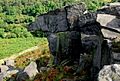
A rocky outcrop on Gibbet Moor
