Gibsonburg, Ohio facts for kids
Quick facts for kids
Gibsonburg, Ohio
|
|
|---|---|
|
Village
|
|

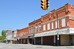
Madison Street from Main Street, downtown
|
|

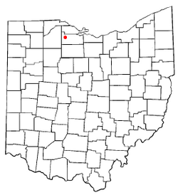
Location of Gibsonburg, Ohio
|
|

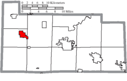
Location of Gibsonburg in Sandusky County
|
|
| Country | United States |
| State | Ohio |
| County | Sandusky |
| Government | |
| • Type | Village council |
| Area | |
| • Total | 2.79 sq mi (7.23 km2) |
| • Land | 2.31 sq mi (5.99 km2) |
| • Water | 0.48 sq mi (1.24 km2) |
| Elevation | 682 ft (208 m) |
| Population
(2020)
|
|
| • Total | 2,452 |
| • Estimate
(2023)
|
2,480 |
| • Density | 1,059.18/sq mi (409.02/km2) |
| Time zone | UTC-5 (Eastern (EST)) |
| • Summer (DST) | UTC-4 (EDT) |
| ZIP code |
43431
|
| Area code(s) | 419 |
| FIPS code | 39-30072 |
| GNIS feature ID | 2398959 |
Gibsonburg is a small village located in Sandusky County, Ohio, in the United States. It is about 33 miles (53 km) southeast of the city of Toledo. In 2020, the village had a population of 2,452 people. Gibsonburg is recognized as a Tree City USA by the National Arbor Day Foundation. This means the village is committed to caring for its trees and green spaces.
Contents
History of Gibsonburg
Gibsonburg began in the year 1871. It was founded by General William H. Gibson. He planned the town after a railroad line was built there. Gibsonburg officially became a village in 1880.
Geography and Location
Gibsonburg is located in the state of Ohio. The village covers a total area of about 2.88 square miles (7.46 square kilometers). Most of this area, about 2.40 square miles (6.22 square kilometers), is land. The remaining 0.48 square miles (1.24 square kilometers) is water.
Population and People
| Historical population | |||
|---|---|---|---|
| Census | Pop. | %± | |
| 1880 | 589 | — | |
| 1890 | 585 | −0.7% | |
| 1900 | 1,791 | 206.2% | |
| 1910 | 1,864 | 4.1% | |
| 1920 | 1,737 | −6.8% | |
| 1930 | 2,129 | 22.6% | |
| 1940 | 2,169 | 1.9% | |
| 1950 | 2,281 | 5.2% | |
| 1960 | 2,540 | 11.4% | |
| 1970 | 2,585 | 1.8% | |
| 1980 | 2,479 | −4.1% | |
| 1990 | 2,579 | 4.0% | |
| 2000 | 2,506 | −2.8% | |
| 2010 | 2,581 | 3.0% | |
| 2020 | 2,452 | −5.0% | |
| 2023 (est.) | 2,480 | −3.9% | |
| U.S. Decennial Census | |||
Population in 2010
According to the census from 2010, there were 2,581 people living in Gibsonburg. These people lived in 982 households, and 656 of these were families. The village had about 1075 people per square mile (415 people per square kilometer).
Most of the people in Gibsonburg were White (94.2%). About 8.6% of the population identified as Hispanic or Latino. The average age of people in the village was 36.9 years old. About 26.2% of the residents were under 18 years old.
Education in Gibsonburg
The Gibsonburg Exempted Village School District manages the schools in the area. This district operates one elementary school and one middle school. It also runs Gibsonburg High School.
Gibsonburg has a public library where people can borrow books and use resources. It is a branch of the Birchard Public Library Of Sandusky County.
Images for kids
See also
 In Spanish: Gibsonburg (Ohio) para niños
 | Ernest Everett Just |
 | Mary Jackson |
 | Emmett Chappelle |
 | Marie Maynard Daly |


