Gippsland Plains Rail Trail facts for kids
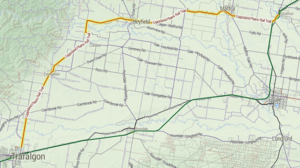
The Gippsland Plains Rail Trail is a super fun path for walking, cycling, and even horse riding! It's 67 kilometers long and follows an old train line. This trail stretches between the towns of Traralgon and Stratford in Central Gippsland, Victoria. As you travel along the trail, you'll see beautiful dairy farms, gentle hills near the Great Dividing Range, and wide-open plains.
The train line was built way back in 1883. It was a very busy route until the 1950s! Trains used to carry important things like sugar beet from Maffra and timber from Heyfield.
The towns you'll pass through on the trail are: Traralgon, Glengarry, Toongabbie, Cowwarr, Heyfield, Maffra and Stratford.
Contents
Exploring the Trail
The Gippsland Plains Rail Trail is split into different sections. Each part offers something new to see and do!
Traralgon to Glengarry (10 km)
This part of the trail starts where Marshalls Road meets the Traralgon-Maffra Road. You'll ride or walk through the lovely Latrobe River floodplain. Get ready to cross four amazing old bridges that have been fixed up!
Glengarry to Toongabbie (9 km)
This section has a smooth, well-packed gravel path. It leads you to Eaglehawk Creek, which is a great spot for a picnic. Toongabbie is a cool town to explore. It has wetlands and a special memorial for Ned Stringer.
Toongabbie to Cowwarr (9 km)
Here, you'll find another well-made gravel path. It takes you across open plains with awesome views of the Great Dividing Range. The trail goes through a beautiful red gum forest and green farmland. You can even spot old parts of the Cowwarr Railway Station!
About Cowwarr
The small town of Cowwarr has a history linked to the gold rush. Today, you can still see old buildings. The Cowwarr Butter Factory is now an art space. There's also the original Cowwarr General Store and a hotel called The Cricket Club.
Cowwarr to Dawson to Heyfield (11 km)
This section also has a well-packed gravel surface. As you leave Cowwarr, you'll pass the pretty Rainbow Creek. The trail goes through rich river flats. You'll also ride through the Dawson Flora Reserve. This reserve is home to many special plants along the trail.
Heyfield Highlights
When you reach Heyfield, you'll find several places to eat. There are also places to stay if you want to rest for the night.
Heyfield to Tinamba (10 km)
This part of the trail follows the side of the Traralgon-Maffra Road for about one kilometer. Then, it crosses the road and heads northeast. This section is flat and easy to ride on the well-packed gravel. Many parts of this trail have recently been made even better!
Tinamba to Maffra (8 km)
This section of the trail has an excellent surface. You'll pass through wetlands, forests, and cross several creeks. You can see parts of an old railway bridge just after Riversdale Road, near Maffra. The trail goes through a thick forest before reaching the Macalister River. A bridge crossing takes you to Macalister Park.
Maffra Attractions
The historic town of Maffra is popular with visitors. You can learn about the town's connection to the sugar beet industry from the early 1900s. Today, you can visit the Beet Museum. The Gippsland Vehicle Collection is also a very popular place to see cool cars and vehicles!
Maffra to Powerscourt to Stratford (10 km)
This final section of the trail follows the main railway line. It goes through classic country scenery. The path is flat, solid, and easy to ride.
Rail Trail Map
 Geographic data related to Gippsland Plains Rail Trail at OpenStreetMap
 | Emma Amos |
 | Edward Mitchell Bannister |
 | Larry D. Alexander |
 | Ernie Barnes |


